Address Fabric™
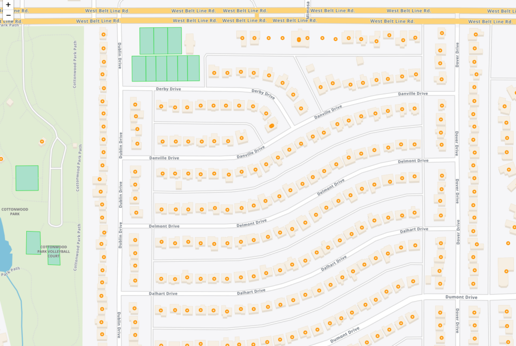
The Address Fabric™ data set is a current and comprehensive list of all known addresses in the United States, Canada, the United Kingdom, Australia, New Zealand and France. Each record is pre-geocoded with precise latitude and longitude, including non-deliverable physical locations, and is delivered in an easy-to-use flat file format for database and analytics integration. Records include street address, coordinate location, census information, property details, and parent/child relationships for primary and secondary addresses. Each record is assigned a unique PreciselyID for data management and enrichment with additional contextual information.
Dynamic Neighborhoods
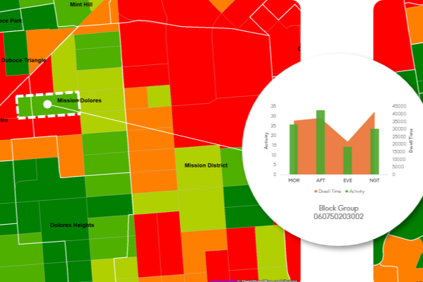
Dynamic Neighborhoods provides a powerful view of how populations move, gather, and engage across communities by combining rich visitation and demographic data. It reveals how busy neighborhoods are, how populations flow through them, and how these dynamics shift across different demographic cohorts and over time. The dataset is analysis-ready with pre-aggregated information at the U.S. census block group level and pre-calculated metrics on activity, dwell time, and location importance.
StreetPro Navigation Premium
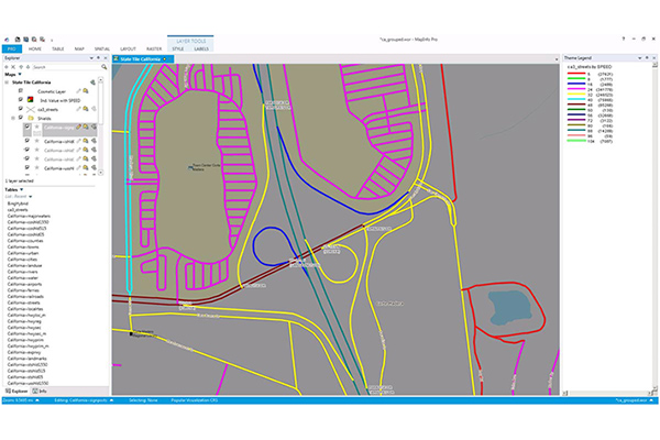
StreetPro Navigation Premium enhances StreetPro Display by enabling precise and efficient route calculation between points on a road network, considering estimated travel speed and vehicle restrictions. It includes all features of StreetPro Display plus address, turn restrictions, and speed information, allowing various geographic and spatial functions not available with other online basemap providers. It features a single connected road network with average speed profiles for time of day and height, width, and weight restrictions. Scale 1:10,000
Buildings
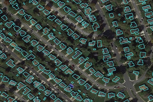
Precisely Buildings provides detailed footprints enriched with characteristics to provide property insights for insurers, telecoms, and location-based analytics. It includes unique identifiers, property essentials (FIPS, census block, address details), building basics (type and usage), location, and elevation (lowest, highest, and centroid). It enables interoperability and enrichment with other features like parcel boundaries and property characteristics, and is available via Data Graph API.
GroundView Demographics
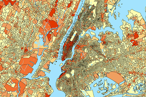
GroundView datasets deliver vital socioeconomic information within a geographic context for a deeper understanding of current and potential markets, including household income and consumer spending habits. It provides thousands of variables for insights at the block group level to support intelligence-based marketing, planning, and expansion strategies.
StreetPro Traffic
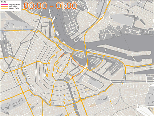
StreetPro Traffic provides information about relative traffic volumes on the StreetPro network, using anonymous feeds from billions of positioning devices within vehicles to offer speed, time, and direction of travel information. It provides aggregate counts of probe devices on road segments, aggregated as annual averages per direction of travel by day of week and hour of day, including additional aggregations for total average weekly, weekday, and weekend probe counts by hour of the day.
ExchangeInfo Plus
ExchangeInfo Plus is an essential tool for visualizing and analyzing the telecommunications landscape and associated infrastructure data to support better business decisions. It is a comprehensive database containing key telecommunications infrastructure data for every wire center in the U.S. and Canada, describing the organization of the local telephone exchange system.
EmergencyInfo Pro
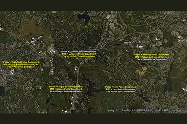
EmergencyInfo Pro is a compilation of Public Safety Answer Point (PSAP) and Authority Having Jurisdiction (AHJ) agencies throughout the United States, providing a geographic depiction of the EmergencyInfo system. It helps users determine which 911 call center serves emergency calls at a particular location and supplies unique contact information for emergency medical service (EMS), fire, or police agencies. It is a database of police, fire, and EMS service areas in the U.S., essential for understanding public safety infrastructure as mobile phones replace landlines.
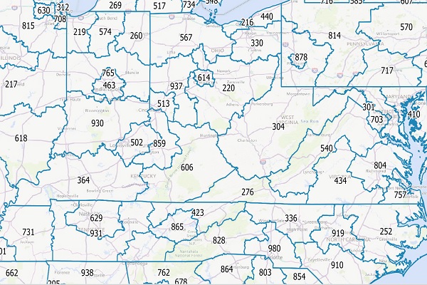
CallingAreaInfo
CallingAreaInfo represents the local calling plans available to business and residential customers when calling from or into a given location. It includes details on number plan areas (NPAs), the first three digits of the phone number after the area code (NXXs), and associated rates. It offers advanced data and geographic visualization capabilities to identify, analyze, and understand local calling plans and rate structures for specific geographic regions.
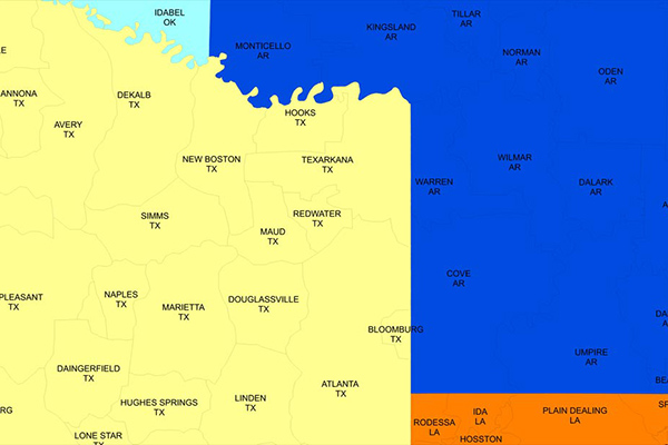
AreaCodeInfo
AreaCodeInfo represents delineated boundaries for landline telecommunications across the U.S. and Canada, covering 353 area codes with regular updates for accuracy.
FSA and 6-Digit Postal Codes
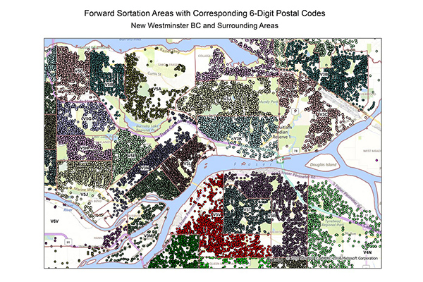
FSA and 6-Digit Postal Codes are available separately or in a bundle. The FSA file contains polygon boundary files and centroids for Canada’s Forward Sortation Areas (FSAs). The 6-Digit Postal Codes file contains over 800,000 postal records and over 4,000 new postal codes, including latitude and longitude coordinates and a single “most representative point” for each postal code in Canada.
Francièmes Boundaries
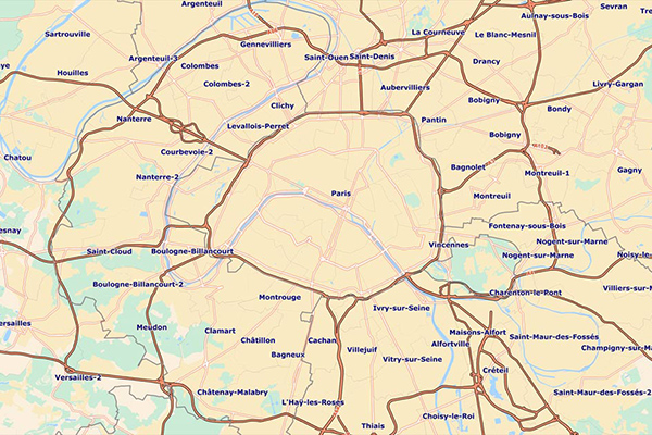
Francièmes Boundaries is a valuable complement to Neighborhood, Residential, and other boundary datasets to help visualize where census polygons overlap with other boundaries in France. Boundary layers include Cantons, Communes, IRIS, and Postaux.