ABS Boundary Pack
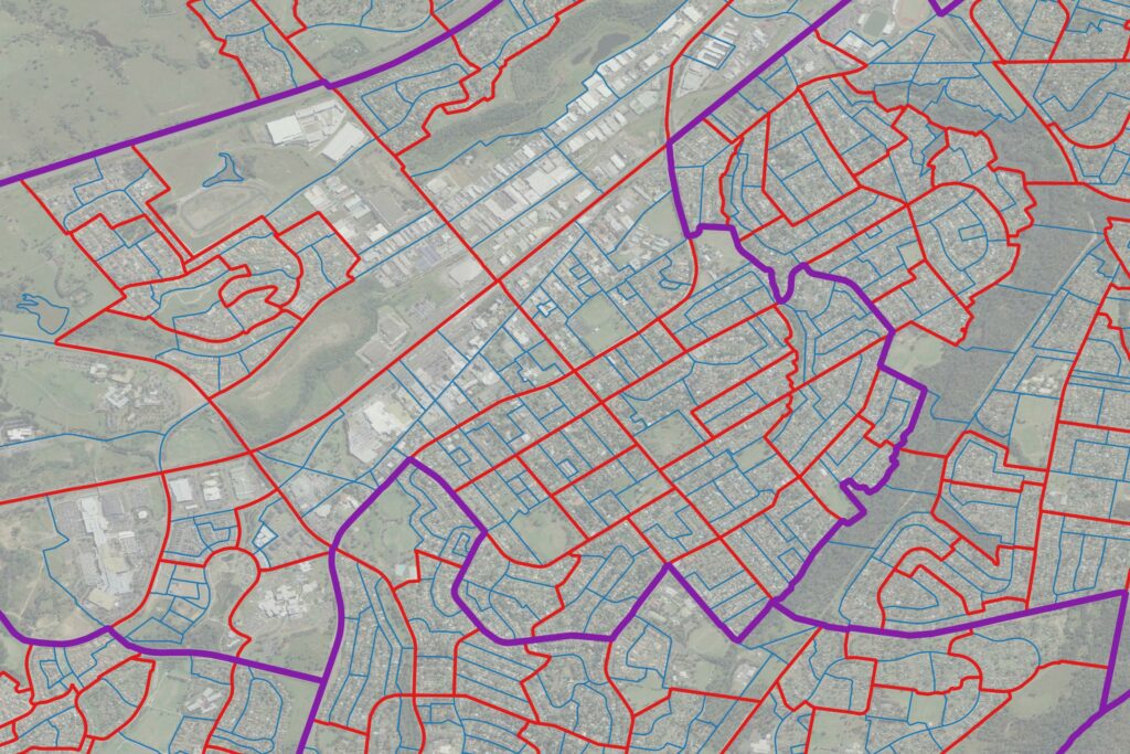
The ABS Boundary Pack provides a complete set of Australian geographic boundaries applicable to the Census of Population and Housing as well as other data from the Australian Bureau of Statistics.
Airports
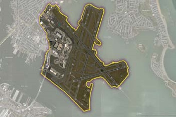
The Airports dataset provides precise delineation of public and private airport facilities, including terminals, hangars, maintenance buildings, runways, helipads, tarmacs, parking areas, and satellite lots, using authoritative sources such as the Federal Aviation Administration (FAA) and the National Flight Data Center (NFDC), with continual updates to ensure accuracy and currency.
ZIP Codes and Carrier Routes
The content describes multiple datasets related to USPS ZIP Codes, including Carrier Routes, ZIP Plus 4s, and ZIP Code Boundaries and Centroids. ZIP Plus 4s identify over 60 million deliverable USPS ZIP Plus 4s and correlate with U.S. census block data. ZIP Code Boundaries provide spatial demarcations and include centroids, while Carrier Routes represent areas served by USPS mail carriers, following roads for accuracy.
World Points of Interest – Premium – Consumer
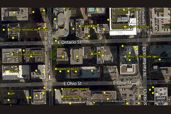
The World Points of Interest Premium Consumer dataset provides location and detailed company information for consumer-focused retail and service businesses, leisure, landmarks, and geographic features in more than 175 countries and territories. It includes a unique identifier, PreciselyID, for each addressable POI to streamline data management and enrichment.
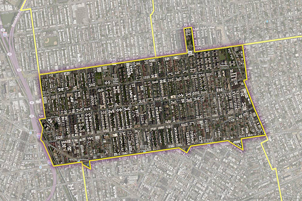
Residential Boundaries
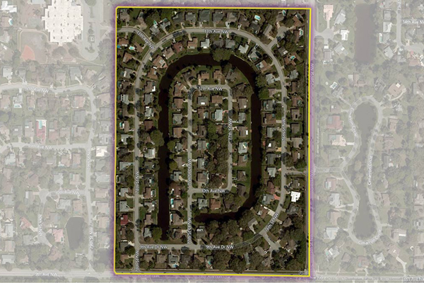
Residential Boundaries provides geographic boundaries, names, and other locational classifications that define the extent and character of residential neighborhoods. Each polygon covers geography that consists of at least 90% residential housing, including homes, condos, and apartment complexes. The acquisition system ensures the most current information is used to define and name a residential area.
Neighborhood Boundaries
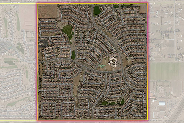
Neighborhood Boundaries identifies and names neighborhoods as experienced by local residents, providing data on population, demographics, culture, and other attributes, along with a hierarchy of precisely validated names and boundaries.
Metro Areas
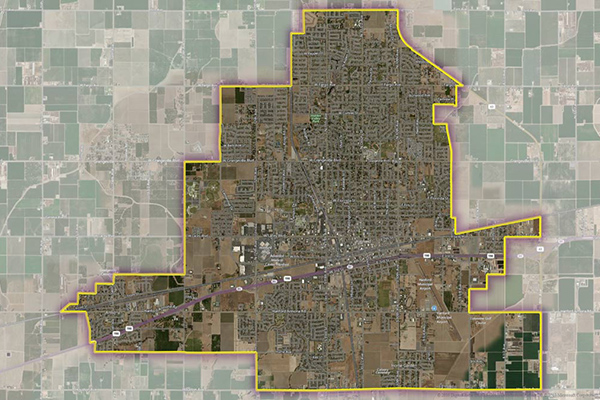
Metro Areas represents over 1,000 major metropolitan areas around the world, including top real estate markets. These areas incorporate satellite cities, towns, and rural areas that are socioeconomically linked to an urban core, typically with a population greater than 50,000 and a density of at least 1,000 people per square mile.
LATAInfo
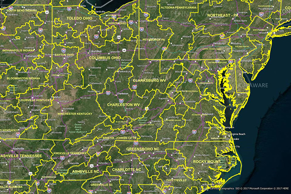
LATAInfo is a map database of Local Access Transport Areas (LATAs) across the United States, used to determine whether a telephone call is carried by a local exchange carrier or a long-distance provider. Each LATA generally contains a single major metropolitan area, with calls within a LATA routed by Local Exchange Carriers (LECs) and calls between different LATAs transported by long-distance carriers.
Consumer Spend Potential
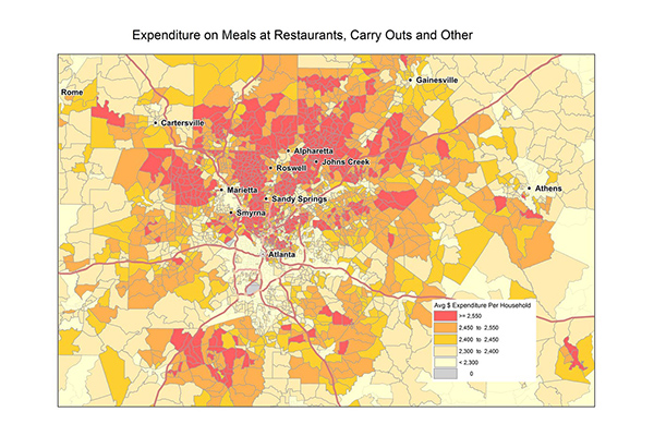
Consumer Spend Potential provides consumer spending data across a broad range of categories. Annual expenditures are calculated using the ratio between disposable income, demographics, and expenditures for products and services derived from household budget surveys from national statistical offices.
Context Demographics
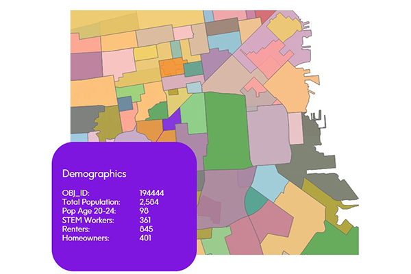
Context Demographics provides U.S. Census and American Community Survey data projected onto Precisely polygons for a deeper understanding of the demographic makeup of specific geographic areas.