Precisely Advances Agentic-Ready Data with a New AI Agent, Data Product Marketplace, and MCP-Enabled APIs Read press release
Build solutions faster with Precisely APIs, pre-linked data, and MCPStart free trial
Privacy Notice Updates: We’ve updated our Privacy Notices to reflect changes to our services, new legal requirements, and the types of personal data we collect. Learn more
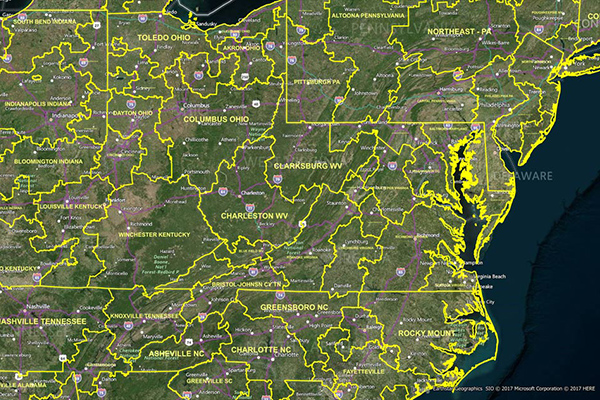
LATAInfo is a map database of Local Access Transport Areas (LATAs) across the United States, used to determine whether a telephone call is carried by a local exchange carrier or a long-distance provider. Each LATA generally contains a single major metropolitan area, with calls within a LATA routed by Local Exchange Carriers (LECs) and calls between different LATAs transported by long-distance carriers.
Coverage
United States
Product Family
Boundaries
Usage
Using LATAInfo enables you to:
Easily differentiate calls carried by a Local Exchange Carrier (LEC) from those carried by a long-distance provider
Identify the best markets for growth in local telecommunications traffic
Make more informed decisions, control costs, and identify marketing opportunities
LATAInfo converts information on the nation’s local access and long-distance markets that was previously available only in tabular format, into a concise, easy-to-use map
The LATAInfo database has the following scale, coordinates, and projection: