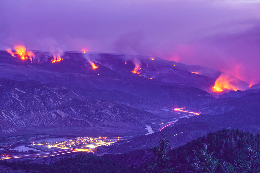
Wildfires have been prominent in the news lately. The 2020 California wildfire season was a record-setting year. By year end, 9,917 fires had burned over 4.2 million acres, making 2020 the largest wildfire season recorded in California’s modern history. The length of fire season is estimated to have increased by 75 days across the Sierras. Insurers are faced with the ever-present challenge of finding ways to assess risk more accurately. Better wildfire risk assessment leads to a better understanding of measures that can be taken to mitigate that risk, as well as more accurate pricing, which is good for consumers and insurers alike.
Wildfire risk data
To better understand risk, you can examine a number of location data points to better understand wildfire behavior and the likelihood of potential losses. Factors such as the distance between structures, proximity of the nearest fire station, and the location and combustibility of nearby vegetation all factor into the equation. Even the relative elevation of combustible materials with respect to a structure can have a meaningful impact on risk.
With a clearer understanding of risk, underwriters are in a better position to price policies appropriately, remaining competitive without undermining profitability. In addition, wildfire risk assessment data can inform decision makers as to the need to apply binding suspension to situations that could otherwise result in losses due to untimely policy changes.
If a wildfire event does occur, risk assessment tools can provide insurers with greater visibility to potential fraud. If assessment models point to a low likelihood of damage in a particular area, claims in that area can be flagged for additional scrutiny. Likewise, if the assessment models indicate a high likelihood of damage, selected claims may be fast-tracked and flagged for remote settlement.
Finally, insurers can use risk assessment to expedite the first notice of loss (FNOL) process and pre-position claims adjustment resources to proactively assist property owners.
Read our White Paper
Wildfire Risk – A hazard and risk assessment database
Read this whitepaper which contains information about wildfire risk model assessements and how they can be used in business and programmatic analytics.
While this kind of intelligence can offer tremendous value for insurance companies, there is a lot that can go wrong. The amount of data involved is quite substantial. Those companies that are successful in mastering the collection, organization, and analysis of that location data will reap very real benefits as a result.
However, given the complexity of the domain, small deviations in accuracy can significantly undermine those benefits. In other words, wildfire risk assessment is complicated, and those who get it right will be at a substantial competitive advantage.
Using location data for assessments
At the heart of the wildfire risk assessment process lies a detailed understanding of multiple elements of the physical world, including structures, vegetation, elevation, wind direction and speed, precipitation, and much more. Even the direction and proximity of roads can affect wildfire patterns. All of those data points are location-specific, that is, they apply to location and movement in the physical world.

Starting with the most accurate, complete, and up-to-date geocoding reference data available is critical to assessing aggregate risk. Precisely has built a best-in-class geocoding reference dataset that includes over 180 million addresses. Unlike other geocoding solutions, the Master Location Data geocoding dataset features a multi-source file that ensures both the highest match rates and maximum accuracy. This address point-level dataset includes virtually all mailable and non-mailable addresses. Through the PreciselyID, a unique and persistent identifier attached to every address record, data enrichment is accomplished for faster, more confident decision making. Easily enrich the customer data with building footprint/rooftop locations, weather patterns, consumer information, boundaries, and more.
Wildfire Risk is Precisely’s scientific and up-to-date wildfire hazard and risk assessment database. It puts that location data to work in sophisticated risk modeling algorithms, using hyper-local weather analysis to understand how risk factors interplay in any given scenario, down to an individual property or structure. By understanding the interplay between fuel, weather, and topography, insurers can zero in on a precise risk calculation for any given policy.
Wildfire Risk uses analysis that factors in those three key elements (fuel, weather, and topography) to model fire behavior, answering questions such as
- “How fast will the fire move?”
- “Where might it get into the tops or crowns of the trees?”
- “How far and in which direction will embers from the fire travel?”
The answers to those questions fit together into a composite score that measures potential severity of fires for a particular area. Wildfire Risk defines areas of common risk known as “firesheds.” Just as a watershed represents a geographical area defined by a natural factor (i.e. water), a fireshed defines a geographical area based on the common behavior of another natural phenomenon, wildfire.
Wildfire Risk provides insurers the ability to identify the potential frequency of wildfire events as well. By modeling the probability of ignition in conjunction with severity and frequency, insurers can gain much deeper insights into wildfire risk.
Wildfire Risk adds information pertaining to factors that mitigate fire risk, such as golf course fairways, vineyards , highways, and industrial parks. Models also account for the proximity of fire suppression resources, including fire stations, water supplies, and more.
Very often, the factors that influence wildfire risk are complex and non-intuitive. The direction of roads relative to prevailing winds, for example, can have a dramatic effect on the dispersion of embers from a fire, which can result in spread. Wildfire Risk takes that into account when calculating risk for structures located in densely populated areas, but appropriately ignores it for rural areas where the lack of any building density renders it meaningless. Risk cannot simply be identified using coarse-grained tools and intuition.
To learn more about taking a data-driven approach to understanding and mitigating wildfire risk, read our white paper Wildfire Risk – A hazard and risk assessment database which contains information about wildfire risk model assessements and how they can be used in business and programmatic analytics.
1. California Department of Forestry and Fire Protection (Cal Fire), Incident Overview
2. Cal Fire, Incident Overview