Address Fabric™
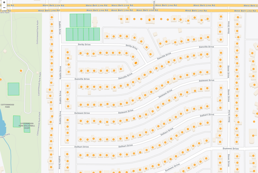
The Address Fabric™ data set is a current and comprehensive list of all known addresses in the United States, Canada, the United Kingdom, Australia, New Zealand and France. Each record is pre-geocoded with precise latitude and longitude, including non-deliverable physical locations, and is delivered in an easy-to-use flat file format for database and analytics integration. Records include street address, coordinate location, census information, property details, and parent/child relationships for primary and secondary addresses. Each record is assigned a unique PreciselyID for data management and enrichment with additional contextual information.
StreetPro™ Discover

StreetPro™ Discover makes it easy to surface and understand street segment data. Designed for AI, it transforms street segments into semantically rich, human-readable data objects, which enables you to ask LLMs questions like “Which streets in this suburb have high traffic exposure?” and immediately get the information you need.
Market Link – Premium Locality Names and Postcodes
Market Link – Premium Locality Names and Postcodes is an enrichment and relationship file that enhances address and place data with comprehensive locality names and detailed attributes, relating postcodes to administrative boundaries and providing more complete postal rosters for better handling of non-geographic postcodes.
World Points of Interest – Premium
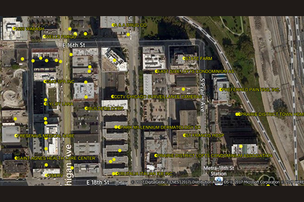
World Points of Interest – Premium provides location and detailed company information for a diverse set of commercial and retail businesses, leisure, landmark, and geographic features in more than 170 countries and territories, covering over 250 million POIs, with more than 27 million in the U.S. It is geocoded using Precisely’s premium geocoding solutions for accuracy and includes a unique PreciselyID for each addressable POI for streamlined data management.
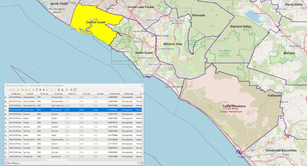
World Boundaries Premium

World Boundaries Premium provides comprehensive coverage of global administrative geographies combined with neighborhood, suburb, land use, and postal geographies. Administrative boundaries from multiple sources for over 200 countries and territories are aggregated in a single dataset, with a single file and table structure for ease of integration.
Boundaries allow users to perform a host of geographic and analytic functions, such as visualizing and manipulating data for map representation or linking company data to accurately locate customers and constituents. They also support a host of forward and reverse geocoding functions, geo-tagging, and geofencing.
The product contains two versions. The geo-tagged version provides all boundaries as one flat boundary file where each polygon represents a unique set of administrative values to the most granular level. The display version provides separate layers for each administrative level.
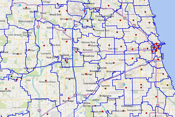
Auto Dealers
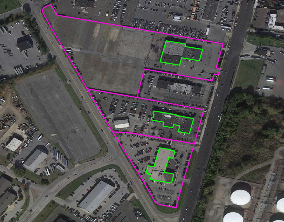
The Auto Dealers dataset provides precise delineation of automotive dealership boundaries, including developed areas for vehicle display, sales and service operations, and overflow lots, along with the primary building footprints for significant structures. Covering both franchise (new car) and independent (used car) dealerships.
Daytime Population
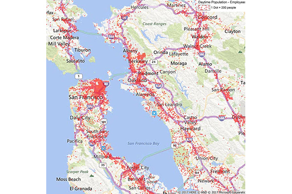
Daytime Population provides estimates of the number of people likely to be within a designated area during normal business hours, based on compiled business data including the number of employees at each business location. These estimates are aggregated to calculate daytime employees, which are then added to the at-home residential population (including retired, in school, or not in the labor force) to arrive at a total daytime population.
Golf Courses
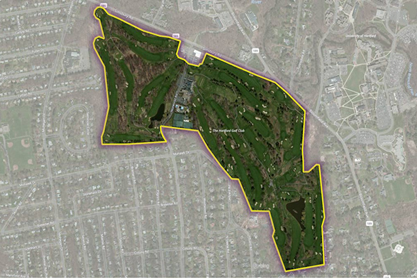
The Golf Courses dataset provides a detailed delineation of the physical extent of public and private golf courses across the United States, including greens, fairways, clubhouses, parking areas, maintenance facilities, outbuildings, and associated residential developments. Developed in partnership with the National Golf Foundation (NGF), this dataset leverages the leading authority on golf course location to deliver the most complete and current spatial dataset.
Context Real Estate
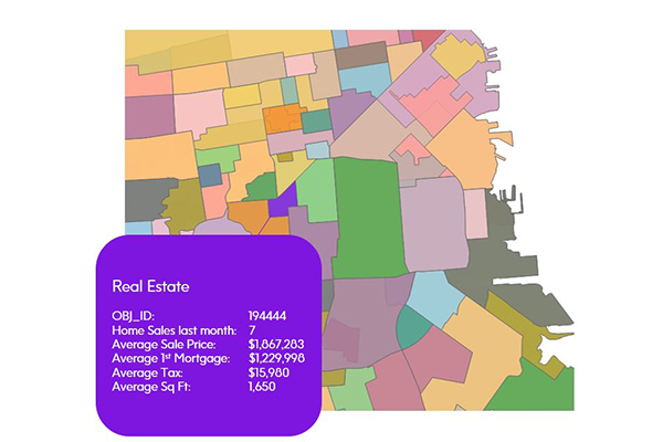
Context Real Estate consists of two datasets: Context Real Estate Sales, providing quarterly analytics of sales trends, average sales price, mortgage metrics, and other sales metrics derived from public records; and Context Real Estate Inventory, offering a snapshot of neighborhood properties including median tax rate, average year built, property types, and occupancy, also derived from public records.
ExchangeInfo Plus
ExchangeInfo Plus is an essential tool for visualizing and analyzing the telecommunications landscape and associated infrastructure data to support better business decisions. It is a comprehensive database containing key telecommunications infrastructure data for every wire center in the U.S. and Canada, describing the organization of the local telephone exchange system.
FSA and 6-Digit Postal Codes
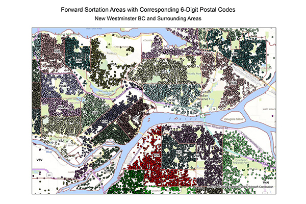
FSA and 6-Digit Postal Codes are available separately or in a bundle. The FSA file contains polygon boundary files and centroids for Canada’s Forward Sortation Areas (FSAs). The 6-Digit Postal Codes file contains over 800,000 postal records and over 4,000 new postal codes, including latitude and longitude coordinates and a single “most representative point” for each postal code in Canada.
Designated Market Areas (DMA®)
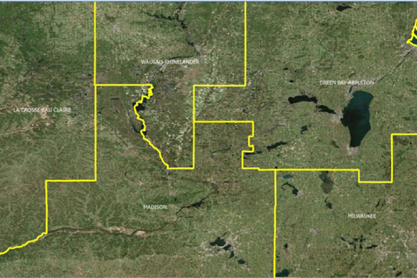
Designated Market Area (DMA®) definitions are licensed from Nielsen and delineate the geographic boundaries of over 200 distinctive regions to assess TV penetration of audience counts within the U.S. for a viewership year. DMA® is a registered service mark of the Nielsen company. Used under License. The DMA® code is created using Nielsen’s assignment of a 3-digit number for identification and processing purposes.