Core Based Statistical Areas (CBSA)
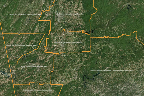
Core Based Statistical Areas (CBSAs) provides the geographic boundaries and point information for more than 900 statistical regions defined by the U.S. Office of Management and Budget, representing highly populated core areas and adjacent communities with high economic and social integration.
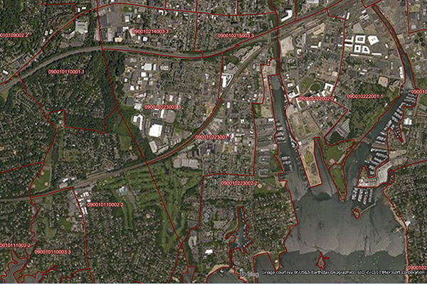
Congressional Districts
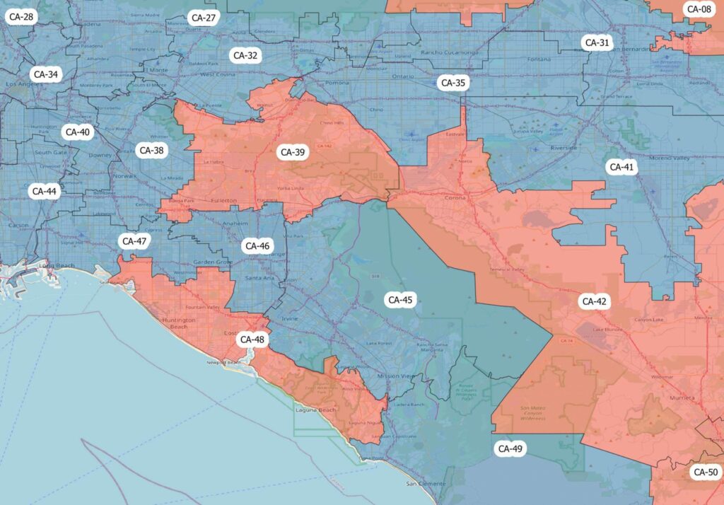
Congressional Districts depicts the physical extent and demographic profile of each district of the U.S. Congress. The dataset includes population estimates, contact information, and party affiliation for each current congressional representative at the time, along with previous congressional districts for historical comparison.
BoundaryLine
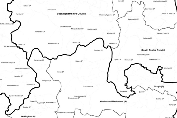
BoundaryLine contains all levels of electoral and administrative boundaries for Great Britain, including districts, wards, civil parishes, and communities, as well as European, assembly, and parliamentary constituencies. It offers a compilation of 54 datasets detailing Great Britain’s administrative and voting boundaries.
GeoVision
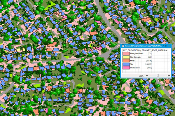
GeoVision provides a nationwide representation of the built environment in Australia. It offers detailed building information including building height, roofing information, overhanging trees, solar panels, and swimming pools, with accuracy and detail for urban, regional, rural, and remote areas.
Airports
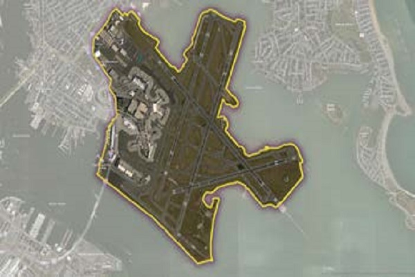
The Airports dataset provides precise delineation of public and private airport facilities, including terminals, hangars, maintenance buildings, runways, helipads, tarmacs, parking areas, and satellite lots, using authoritative sources such as the Federal Aviation Administration (FAA) and the National Flight Data Center (NFDC), with continual updates to ensure accuracy and currency.
World Points of Interest – Premium – Consumer
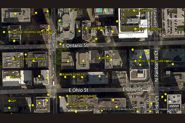
The World Points of Interest Premium Consumer dataset provides location and detailed company information for consumer-focused retail and service businesses, leisure, landmarks, and geographic features in more than 175 countries and territories. It includes a unique identifier, PreciselyID, for each addressable POI to streamline data management and enrichment.
US Municipal Boundaries
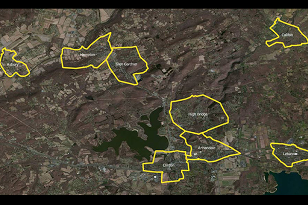
US Municipal Boundaries contains up-to-date information on the boundaries of incorporated municipalities, updated quarterly to include new incorporations, annexations, de-annexations, mergers, consolidations, dis-incorporations, and/or dissolution of local governmental entities.
Suburbs and Localities Australia
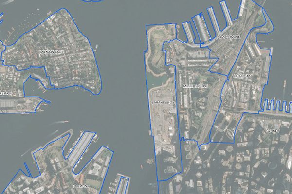
Suburbs and Localities Australia provides authoritative geographic demarcations of gazetted suburb boundaries and non-gazetted locality boundaries in a single table format, with over 15,000 suburb and locality boundaries, key for mapping and linking business data for geographic analysis.
World Postcode and Administrative Boundaries
World Postcode and Administrative Boundaries provides comprehensive coverage of global administrative and postcode boundaries, offering six administrative levels for analysis specific to each country, such as township or city boundaries. It includes administrative hierarchy and alternate postal names for the U.S. and Australia, aggregating worldwide postal and administrative boundaries into a single product with a consistent, single table structure format for ease of use.