Address Fabric™
The Address Fabric™ data set is a current and comprehensive list of all known addresses in the United States, Canada, the United Kingdom, Australia, New Zealand and France. Each record is pre-geocoded with precise latitude and longitude, including non-deliverable physical locations, and is delivered in an easy-to-use flat file format for database and analytics integration. Records include street address, coordinate location, census information, property details, and parent/child relationships for primary and secondary addresses. Each record is assigned a unique PreciselyID for data management and enrichment with additional contextual information.
StreetPro™ Discover
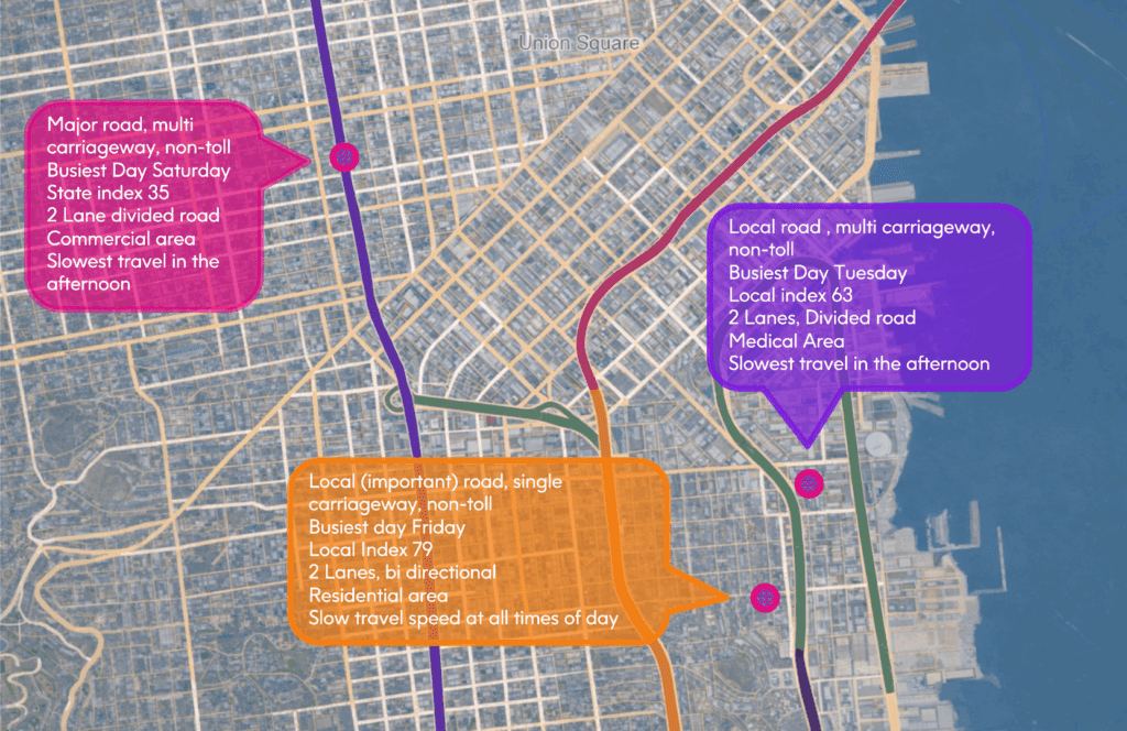
StreetPro™ Discover makes it easy to surface and understand street segment data. Designed for AI, it transforms street segments into semantically rich, human-readable data objects, which enables you to ask LLMs questions like “Which streets in this suburb have high traffic exposure?” and immediately get the information you need.
Property Graph
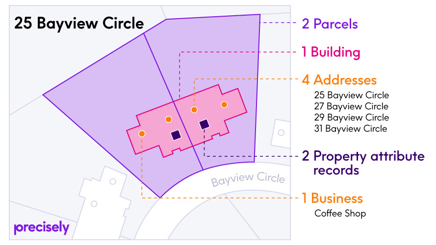
Property Graph simplifies relationships between two or more Precisely data enrichment products, making it easy to join additional datasets for data enrichment and providing a connected view of properties that can be directly integrated with business processes. It is designed for use with Address Fabric, Parcel Boundaries, Buildings, Property Attributes, and Points of Interest.
Wildfire Risk
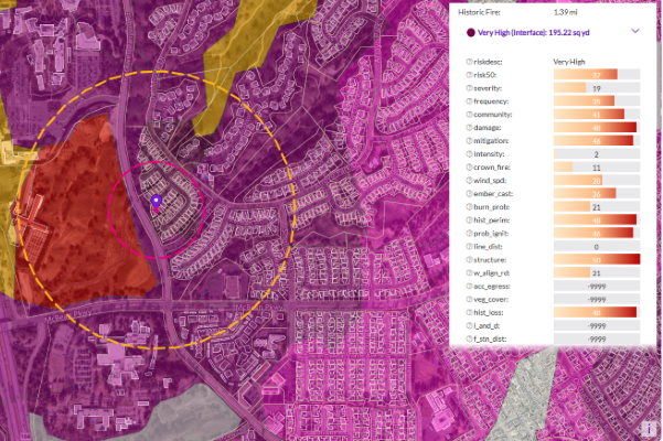
Wildfire Risk is a cutting-edge database that helps assess wildfire hazards and risks. It uses nationally recognized fire behavior methods to predict severity, including flame length, intensity, and ember generation. Inputs include fuel moisture, historic weather, topography, landscape mitigation, and other key factors. The model also factors in past fires, probability, fuel type, and community attributes like neighborhood vegetation, creating a realistic view of severity and vulnerability.
Using these factors, the model creates unique fireshed polygons across the United States, each with its own risk score. Plus, it provides detailed information at the address level, including proximity measurements to help understand the specific risk to individual structures.
Wildfire Risk Extreme
Wildfire Risk Extreme is a companion to Wildfire Risk, designed to help you understand the impact of severe wildfire conditions across the U.S. It takes into account crucial factors like fuel moisture, temperature, humidity, and wind dryness and directions, all key factors in creating extreme fire weather. These factors are essential in predicting fast-spreading wildfires that can ignite urban fires, also known as urban conflagrations.
This tool provides a comprehensive wildfire hazard and risk assessment across the country, detailing extreme burning conditions and predicting where urban conflagration can occur. It delivers actionable information for any location in the U.S. under extreme weather conditions.
Context Walkability
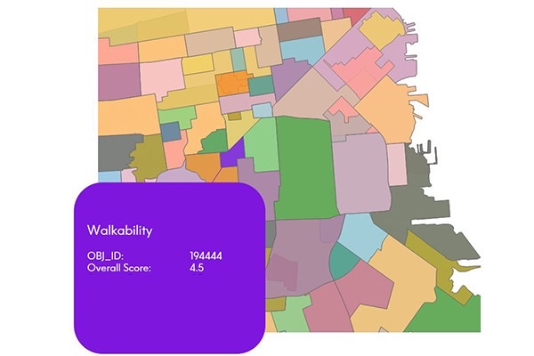
Context Walkability summarizes the level of accessibility to leisure, amenity, and other points of interest when walking. Each walkability score uses data on street intersection density, proximity to transit stops, and variations in land use to measure the probability of people walking as a mode of transportation. Scores range from 0.0 to 5.0, with higher scores indicating geographic regions more conducive to walking.
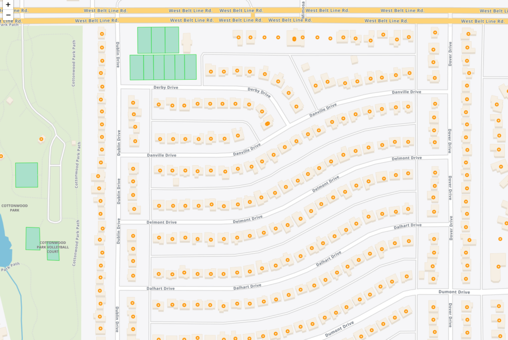
Buildings
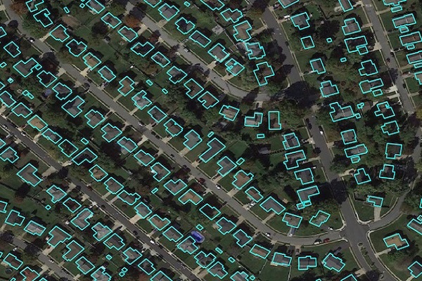
Precisely Buildings provides detailed footprints enriched with characteristics to provide property insights for insurers, telecoms, and location-based analytics. It includes unique identifiers, property essentials (FIPS, census block, address details), building basics (type and usage), location, and elevation (lowest, highest, and centroid). It enables interoperability and enrichment with other features like parcel boundaries and property characteristics, and is available via Data Graph API.
Context School Rankings
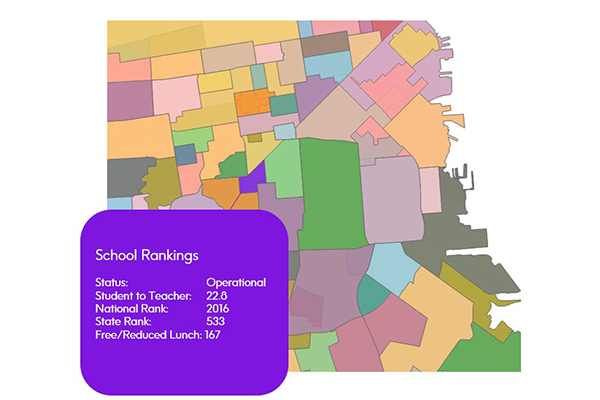
Context School Rankings provides state-wide school performance rankings, math and reading test scores, historical rankings, and school profiles for a specific geographic area. It offers a comprehensive view of public schools throughout the U.S. with over 80 combined attributes, designed to work seamlessly with public school points and school attendance zones data.
Hospitals
The Hospitals dataset provides precise polygonal boundaries for general care hospitals with 24-hour emergency services and specialty facilities such as VA and cancer centres across the United States. Each boundary captures the primary hospital campus, including the main building, patient and visitor parking, and, where appropriate, satellite facilities like clinics and administrative offices.
Context Weather
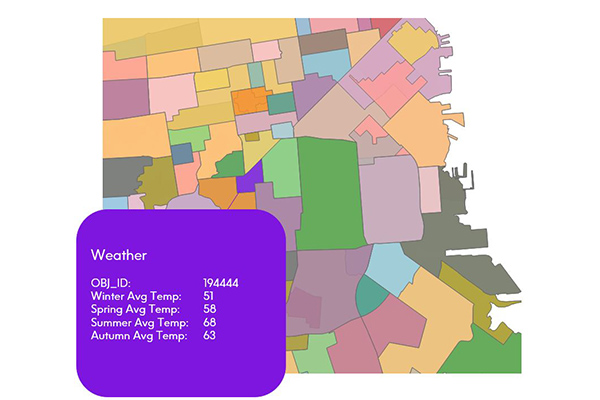
Context Weather provides a series of climate scores derived from measuring and modeling climate data over time and across stratified geographies, including average high and low temperatures, precipitation, snowfall, sunny and cloudy days, wind chill, and heat index by month.
Context Real Estate
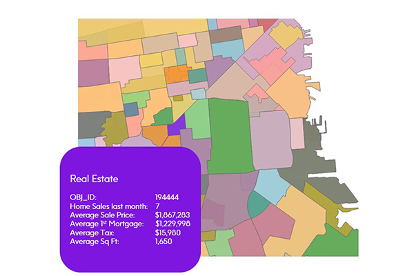
Context Real Estate consists of two datasets: Context Real Estate Sales, providing quarterly analytics of sales trends, average sales price, mortgage metrics, and other sales metrics derived from public records; and Context Real Estate Inventory, offering a snapshot of neighborhood properties including median tax rate, average year built, property types, and occupancy, also derived from public records.
CrimeIndex & Context CrimeIndex
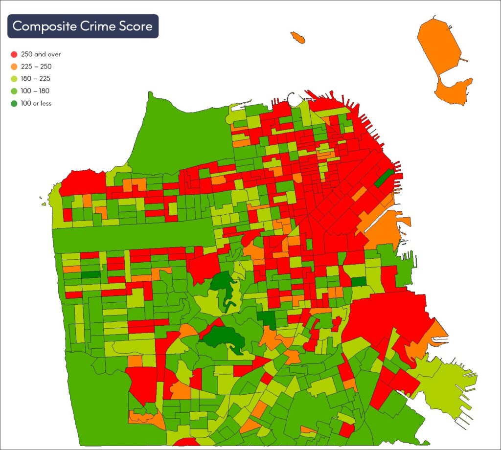
CrimeIndex measures the likelihood of where crime may occur and provides crime risk scores at the granular block group level. Context Crime Index combines Crime Index and Neighborhood Boundaries to provide a comprehensive view of crime data for a neighborhood or local region.
Historical Weather Risk

Historical Weather Risk contains comprehensive historical records of hazardous weather data including hurricane, hail, tornado, and windstorm events, with details on date, severity, and additional attribution like magnitudes, fatalities, injuries, crop/property damages, and meteorological details. Wind events use the Beaufort Wind scale, tornadoes use the Fujita-Pearson scale, hail events use the TORRO intensity scale, and hurricane events reference the Saffir-Simpson scale.