Wildfire Risk
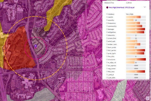
Wildfire Risk is a cutting-edge database that helps assess wildfire hazards and risks. It uses nationally recognized fire behavior methods to predict severity, including flame length, intensity, and ember generation. Inputs include fuel moisture, historic weather, topography, landscape mitigation, and other key factors. The model also factors in past fires, probability, fuel type, and community attributes like neighborhood vegetation, creating a realistic view of severity and vulnerability.
Using these factors, the model creates unique fireshed polygons across the United States, each with its own risk score. Plus, it provides detailed information at the address level, including proximity measurements to help understand the specific risk to individual structures.
Wildfire Risk Extreme
Wildfire Risk Extreme is a companion to Wildfire Risk, designed to help you understand the impact of severe wildfire conditions across the U.S. It takes into account crucial factors like fuel moisture, temperature, humidity, and wind dryness and directions, all key factors in creating extreme fire weather. These factors are essential in predicting fast-spreading wildfires that can ignite urban fires, also known as urban conflagrations.
This tool provides a comprehensive wildfire hazard and risk assessment across the country, detailing extreme burning conditions and predicting where urban conflagration can occur. It delivers actionable information for any location in the U.S. under extreme weather conditions.
PSYTE™ Geodemographic Segmentation
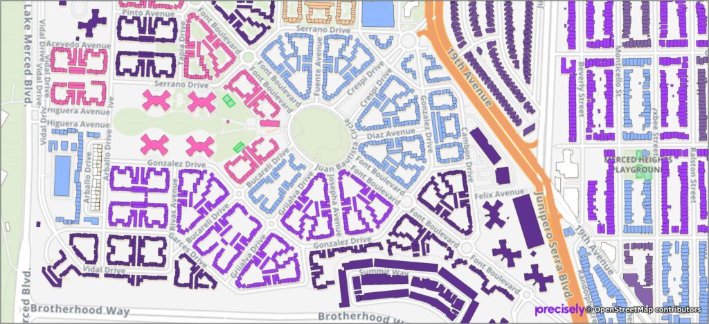
PSYTE™ geodemographic segmentation data products provide an easy-to-understand classification of neighborhoods based on shared socioeconomic and lifestyle characteristics such as age, income, and education. They enable users to understand customers, discover new target markets, and personalize outreach with intuitive neighborhood segmentation based on hundreds of variables and simple labels like “Metropolitan Young Elite.”
Precisely currently offers four PSYTE™ geodemographic data products:
PSYTE™ US geodemographic data
PSYTE™ Canada geodemographic data
PSYTE™ UK geodemographic data
PSYTE™ Australia geodemographic data
StreetPro Navigation Premium
StreetPro Navigation Premium enhances StreetPro Display by enabling precise and efficient route calculation between points on a road network, considering estimated travel speed and vehicle restrictions. It includes all features of StreetPro Display plus address, turn restrictions, and speed information, allowing various geographic and spatial functions not available with other online basemap providers. It features a single connected road network with average speed profiles for time of day and height, width, and weight restrictions. Scale 1:10,000
StreetPro 2500
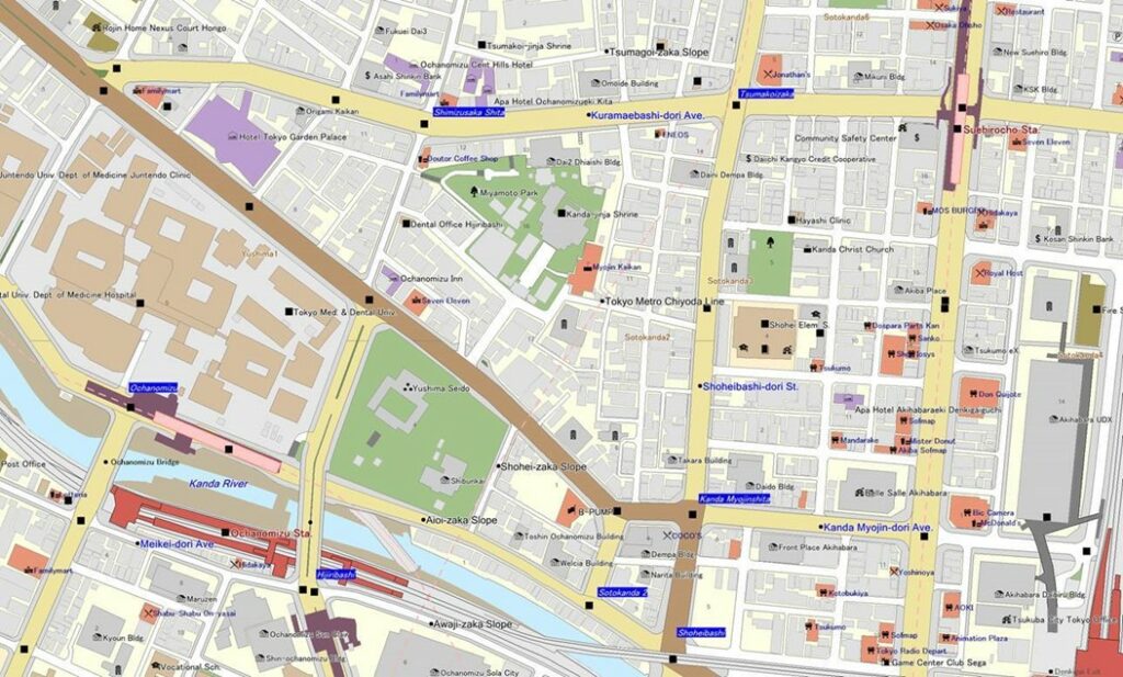
StreetPro 2500 contains map information, including roads and railways, for all of Japan. Detailed building shape outlines are provided for urban areas and their satellite regions, making it possible to determine the precise location of each customer.
StreetPro Display
StreetPro Display is a fully attributed vector GIS dataset containing streets, administrative areas, gazetteer, transport, land use, and points of interest data. It is an attributed, interactive dataset for geographic and spatial functions, built using data from geocoding software, and can be delivered with MapInfo Routefinder Networks for desktop geocoding, backdrop mapping, attributes, and context for drivetime and routing analysis. It provides robust street-level data for mapping, analysis, routing, and geocoding.
Buildings
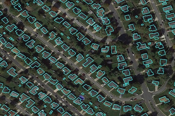
Precisely Buildings provides detailed footprints enriched with characteristics to provide property insights for insurers, telecoms, and location-based analytics. It includes unique identifiers, property essentials (FIPS, census block, address details), building basics (type and usage), location, and elevation (lowest, highest, and centroid). It enables interoperability and enrichment with other features like parcel boundaries and property characteristics, and is available via Data Graph API.
School Grounds
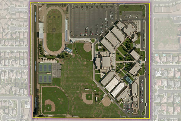
School Grounds provides accurate polygons that define the geographic extent of the campus for public schools across the U.S.
Hospitals
The Hospitals dataset provides precise polygonal boundaries for general care hospitals with 24-hour emergency services and specialty facilities such as VA and cancer centres across the United States. Each boundary captures the primary hospital campus, including the main building, patient and visitor parking, and, where appropriate, satellite facilities like clinics and administrative offices.
Colleges
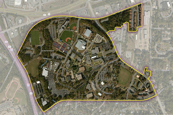
The Colleges dataset provides a series of polygonal boundaries around two-year and four-year colleges and universities in the United States with an enrollment greater than 200, reflecting both main and satellite campuses. Buildings or properties associated with a college are included if adjacent or nearby, but isolated buildings are generally not included. Additional polygons are created for separate facilities with concentrations of students, and some colleges have multiple polygons for geographically dispersed campuses.
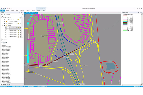
StreetPro Traffic
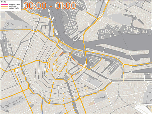
StreetPro Traffic provides information about relative traffic volumes on the StreetPro network, using anonymous feeds from billions of positioning devices within vehicles to offer speed, time, and direction of travel information. It provides aggregate counts of probe devices on road segments, aggregated as annual averages per direction of travel by day of week and hour of day, including additional aggregations for total average weekly, weekday, and weekend probe counts by hour of the day.
EmergencyInfo Pro
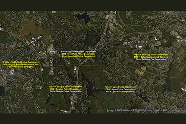
EmergencyInfo Pro is a compilation of Public Safety Answer Point (PSAP) and Authority Having Jurisdiction (AHJ) agencies throughout the United States, providing a geographic depiction of the EmergencyInfo system. It helps users determine which 911 call center serves emergency calls at a particular location and supplies unique contact information for emergency medical service (EMS), fire, or police agencies. It is a database of police, fire, and EMS service areas in the U.S., essential for understanding public safety infrastructure as mobile phones replace landlines.
Historical Weather Risk

Historical Weather Risk contains comprehensive historical records of hazardous weather data including hurricane, hail, tornado, and windstorm events, with details on date, severity, and additional attribution like magnitudes, fatalities, injuries, crop/property damages, and meteorological details. Wind events use the Beaufort Wind scale, tornadoes use the Fujita-Pearson scale, hail events use the TORRO intensity scale, and hurricane events reference the Saffir-Simpson scale.