Market Link – Premium Locality Names and Postcodes
Market Link – Premium Locality Names and Postcodes is an enrichment and relationship file that enhances address and place data with comprehensive locality names and detailed attributes, relating postcodes to administrative boundaries and providing more complete postal rosters for better handling of non-geographic postcodes.
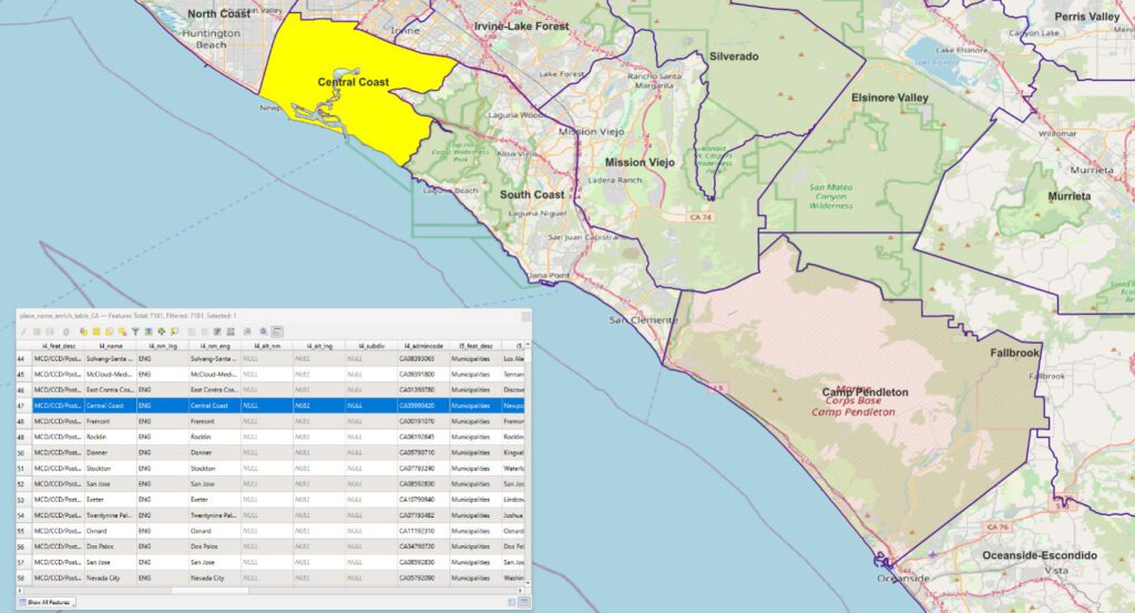
World Boundaries Premium

World Boundaries Premium provides comprehensive coverage of global administrative geographies combined with neighborhood, suburb, land use, and postal geographies. Administrative boundaries from multiple sources for over 200 countries and territories are aggregated in a single dataset, with a single file and table structure for ease of integration.
Boundaries allow users to perform a host of geographic and analytic functions, such as visualizing and manipulating data for map representation or linking company data to accurately locate customers and constituents. They also support a host of forward and reverse geocoding functions, geo-tagging, and geofencing.
The product contains two versions. The geo-tagged version provides all boundaries as one flat boundary file where each polygon represents a unique set of administrative values to the most granular level. The display version provides separate layers for each administrative level.
ExchangeInfo Plus
ExchangeInfo Plus is an essential tool for visualizing and analyzing the telecommunications landscape and associated infrastructure data to support better business decisions. It is a comprehensive database containing key telecommunications infrastructure data for every wire center in the U.S. and Canada, describing the organization of the local telephone exchange system.
EmergencyInfo Pro
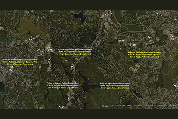
EmergencyInfo Pro is a compilation of Public Safety Answer Point (PSAP) and Authority Having Jurisdiction (AHJ) agencies throughout the United States, providing a geographic depiction of the EmergencyInfo system. It helps users determine which 911 call center serves emergency calls at a particular location and supplies unique contact information for emergency medical service (EMS), fire, or police agencies. It is a database of police, fire, and EMS service areas in the U.S., essential for understanding public safety infrastructure as mobile phones replace landlines.
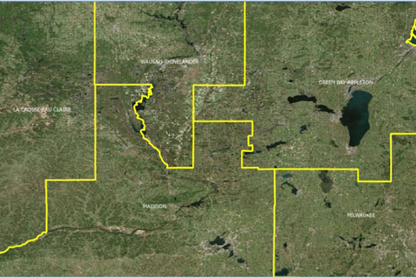
CallingAreaInfo
CallingAreaInfo represents the local calling plans available to business and residential customers when calling from or into a given location. It includes details on number plan areas (NPAs), the first three digits of the phone number after the area code (NXXs), and associated rates. It offers advanced data and geographic visualization capabilities to identify, analyze, and understand local calling plans and rate structures for specific geographic regions.
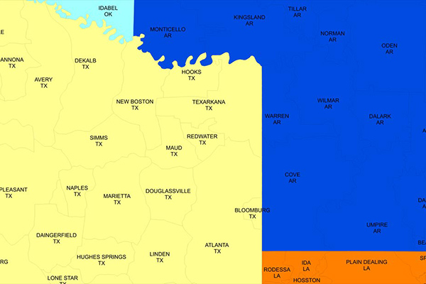
AreaCodeInfo
AreaCodeInfo represents delineated boundaries for landline telecommunications across the U.S. and Canada, covering 353 area codes with regular updates for accuracy.
FSA and 6-Digit Postal Codes
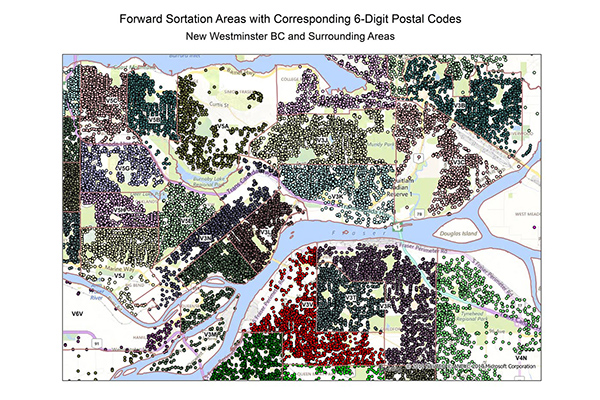
FSA and 6-Digit Postal Codes are available separately or in a bundle. The FSA file contains polygon boundary files and centroids for Canada’s Forward Sortation Areas (FSAs). The 6-Digit Postal Codes file contains over 800,000 postal records and over 4,000 new postal codes, including latitude and longitude coordinates and a single “most representative point” for each postal code in Canada.
Francièmes Boundaries
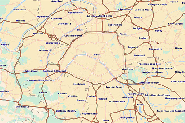
Francièmes Boundaries is a valuable complement to Neighborhood, Residential, and other boundary datasets to help visualize where census polygons overlap with other boundaries in France. Boundary layers include Cantons, Communes, IRIS, and Postaux.
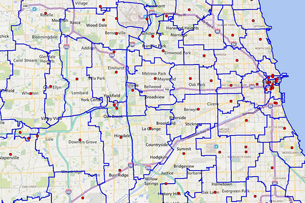
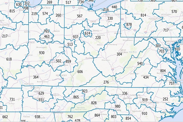
Designated Market Areas (DMA®)
Designated Market Area (DMA®) definitions are licensed from Nielsen and delineate the geographic boundaries of over 200 distinctive regions to assess TV penetration of audience counts within the U.S. for a viewership year. DMA® is a registered service mark of the Nielsen company. Used under License. The DMA® code is created using Nielsen’s assignment of a 3-digit number for identification and processing purposes.
Core Based Statistical Areas (CBSA)
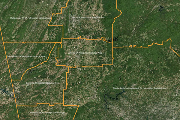
Core Based Statistical Areas (CBSAs) provides the geographic boundaries and point information for more than 900 statistical regions defined by the U.S. Office of Management and Budget, representing highly populated core areas and adjacent communities with high economic and social integration.
Congressional Districts
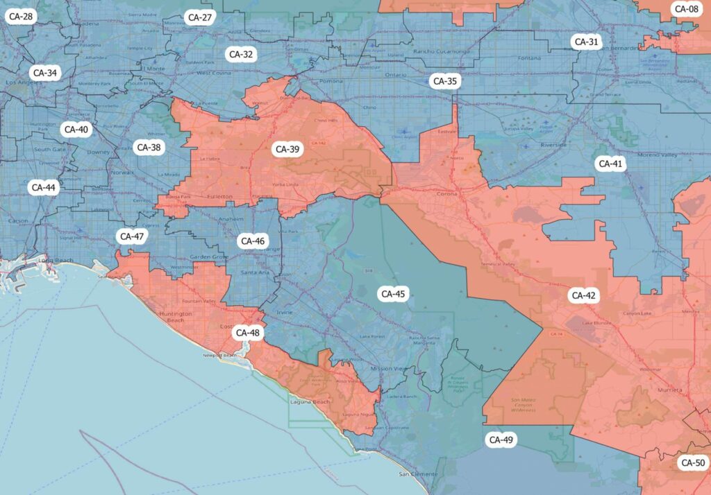
Congressional Districts depicts the physical extent and demographic profile of each district of the U.S. Congress. The dataset includes population estimates, contact information, and party affiliation for each current congressional representative at the time, along with previous congressional districts for historical comparison.
Community and Market Link
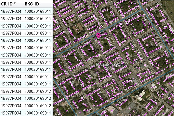
Community and Market Link products provide a flat text file of addresses associated with boundaries, created using location intelligence software to perform point-in-polygon operations. They enable quick and simple lookups to understand relationships between addresses and boundaries, offering insights into customer activity, school districts, and township administration, and can connect with other datasets using the PreciselyID unique address identifier.