Audiences Direct

Audiences Direct is a dataset based on the same data used to create Precisely PlaceIQ Audiences, available for the entire set of syndicated audiences or specific audiences of interest. It allows organizations to mesh Precisely PlaceIQ audience data with their own first-party data to build unique segments for advertisers.
Firehose Visits Dataset

Firehose Visits delivers visitation data for all brands within Precisely PlaceIQ’s full taxonomy, spanning retail, dining, auto, travel, financial services, and more. It includes time-stamped visitation, individual brand location, designated market area (DMA), zip code, state, time zone, and metadata about the place visited. It helps enrich first-party data with real-world attributes to build audience profiles and activate digital campaigns.
Place Visit Stream Direct
Easily measure and enhance the performance of marketing campaigns using foot traffic pattern data to quantify campaign effects and optimize them as needed. It allows attribution of real-world impact of ad spend across platforms, daily measurement of foot traffic at locations, and campaign optimization for visits, not clicks.
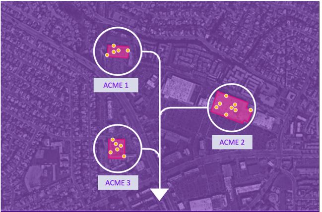
Auto Dealers
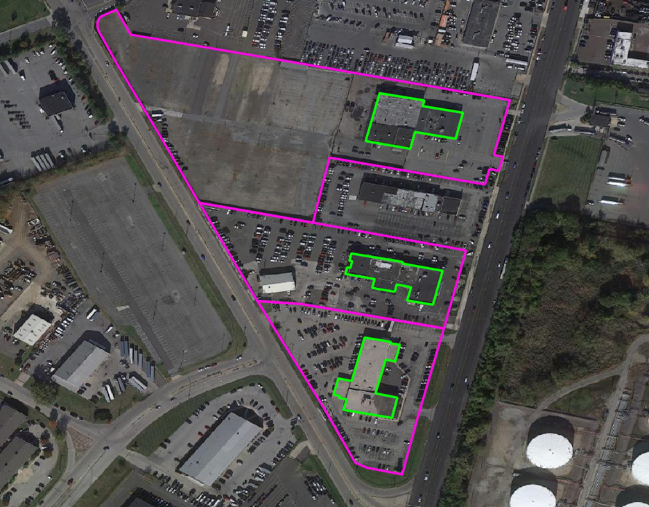
The Auto Dealers dataset provides precise delineation of automotive dealership boundaries, including developed areas for vehicle display, sales and service operations, and overflow lots, along with the primary building footprints for significant structures. Covering both franchise (new car) and independent (used car) dealerships.
Context Walkability
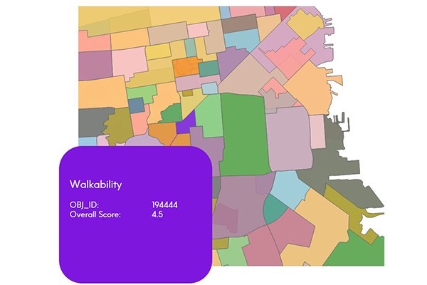
Context Walkability summarizes the level of accessibility to leisure, amenity, and other points of interest when walking. Each walkability score uses data on street intersection density, proximity to transit stops, and variations in land use to measure the probability of people walking as a mode of transportation. Scores range from 0.0 to 5.0, with higher scores indicating geographic regions more conducive to walking.
Estimates and Projections
Estimates and Projections makes it easy to understand current population characteristics and predict future changes in the demographic landscape, based on variables such as total population, total households, population characteristics (age, sex, composition), and household characteristics (income). These variables are updated to current year and projection values using rigorous, proprietary processes.
StreetPro Display
StreetPro Display is a fully attributed vector GIS dataset containing streets, administrative areas, gazetteer, transport, land use, and points of interest data. It is an attributed, interactive dataset for geographic and spatial functions, built using data from geocoding software, and can be delivered with MapInfo Routefinder Networks for desktop geocoding, backdrop mapping, attributes, and context for drivetime and routing analysis. It provides robust street-level data for mapping, analysis, routing, and geocoding.
Buildings
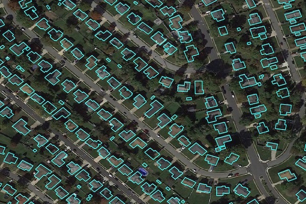
Precisely Buildings provides detailed footprints enriched with characteristics to provide property insights for insurers, telecoms, and location-based analytics. It includes unique identifiers, property essentials (FIPS, census block, address details), building basics (type and usage), location, and elevation (lowest, highest, and centroid). It enables interoperability and enrichment with other features like parcel boundaries and property characteristics, and is available via Data Graph API.
Daytime Population
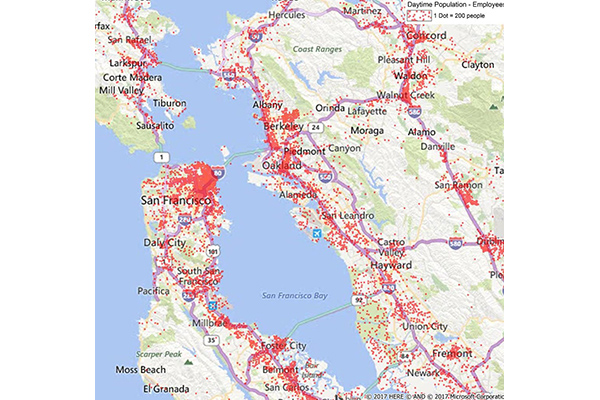
Daytime Population provides estimates of the number of people likely to be within a designated area during normal business hours, based on compiled business data including the number of employees at each business location. These estimates are aggregated to calculate daytime employees, which are then added to the at-home residential population (including retired, in school, or not in the labor force) to arrive at a total daytime population.
GroundView Demographics
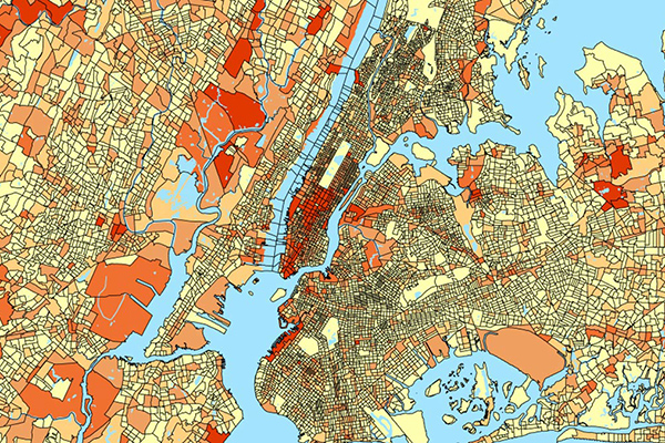
GroundView datasets deliver vital socioeconomic information within a geographic context for a deeper understanding of current and potential markets, including household income and consumer spending habits. It provides thousands of variables for insights at the block group level to support intelligence-based marketing, planning, and expansion strategies.
Context School Rankings
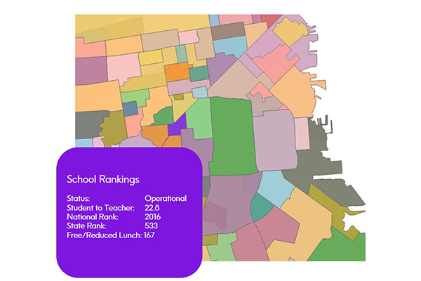
Context School Rankings provides state-wide school performance rankings, math and reading test scores, historical rankings, and school profiles for a specific geographic area. It offers a comprehensive view of public schools throughout the U.S. with over 80 combined attributes, designed to work seamlessly with public school points and school attendance zones data.
Context Commuter Score
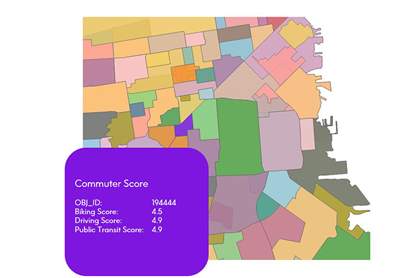
Context Commuter Score provides transportation data which allows users to rate the navigability of an underlying geography. Scores range from 0.0-5.0, with a higher score indicating more commuter opportunities. Biking, driving, and public transit data are all provided and scored.