Global Demographics
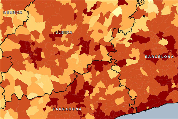
Global Demographics provides comprehensive coverage of global demographics such as population, age, sex, race, and disposable income as they relate to local administrative and/or postal geographies, extending to 140 countries globally, offering information on 6.7 billion consumers.
School Grounds
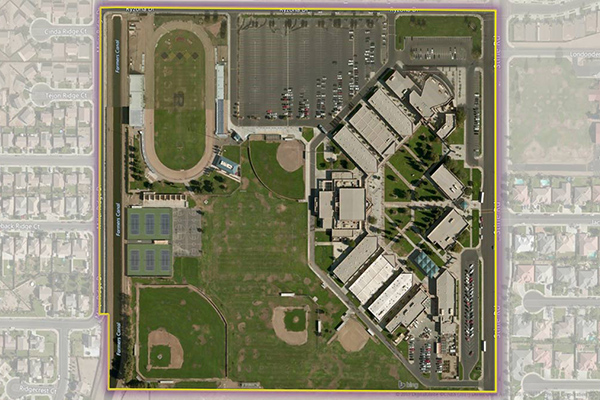
School Grounds provides accurate polygons that define the geographic extent of the campus for public schools across the U.S.
Hospitals
The Hospitals dataset provides precise polygonal boundaries for general care hospitals with 24-hour emergency services and specialty facilities such as VA and cancer centres across the United States. Each boundary captures the primary hospital campus, including the main building, patient and visitor parking, and, where appropriate, satellite facilities like clinics and administrative offices.
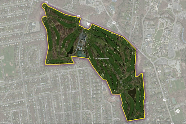
Golf Courses

The Golf Courses dataset provides a detailed delineation of the physical extent of public and private golf courses across the United States, including greens, fairways, clubhouses, parking areas, maintenance facilities, outbuildings, and associated residential developments. Developed in partnership with the National Golf Foundation (NGF), this dataset leverages the leading authority on golf course location to deliver the most complete and current spatial dataset.
Colleges
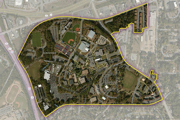
The Colleges dataset provides a series of polygonal boundaries around two-year and four-year colleges and universities in the United States with an enrollment greater than 200, reflecting both main and satellite campuses. Buildings or properties associated with a college are included if adjacent or nearby, but isolated buildings are generally not included. Additional polygons are created for separate facilities with concentrations of students, and some colleges have multiple polygons for geographically dispersed campuses.
StreetPro Traffic
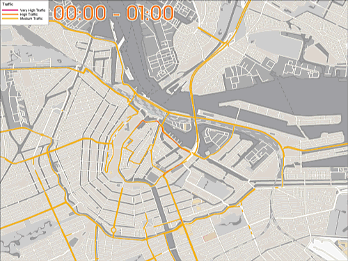
StreetPro Traffic provides information about relative traffic volumes on the StreetPro network, using anonymous feeds from billions of positioning devices within vehicles to offer speed, time, and direction of travel information. It provides aggregate counts of probe devices on road segments, aggregated as annual averages per direction of travel by day of week and hour of day, including additional aggregations for total average weekly, weekday, and weekend probe counts by hour of the day.
Shopping Boundaries
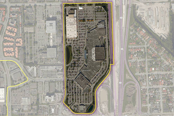
The Shopping Boundaries delineate geographic boundaries around U.S. shopping locations, focusing primarily on larger metropolitan areas. They include buildings or areas associated with shopping locations and are designed to enclose retail stores, services, restaurants, and parking areas.
Context Weather
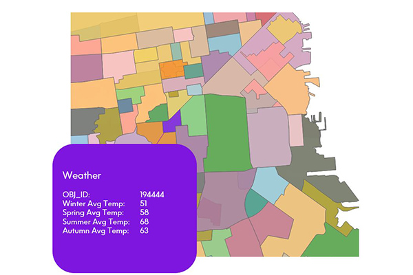
Context Weather provides a series of climate scores derived from measuring and modeling climate data over time and across stratified geographies, including average high and low temperatures, precipitation, snowfall, sunny and cloudy days, wind chill, and heat index by month.
Context Real Estate
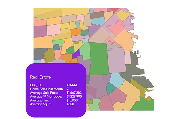
Context Real Estate consists of two datasets: Context Real Estate Sales, providing quarterly analytics of sales trends, average sales price, mortgage metrics, and other sales metrics derived from public records; and Context Real Estate Inventory, offering a snapshot of neighborhood properties including median tax rate, average year built, property types, and occupancy, also derived from public records.
CrimeIndex & Context CrimeIndex
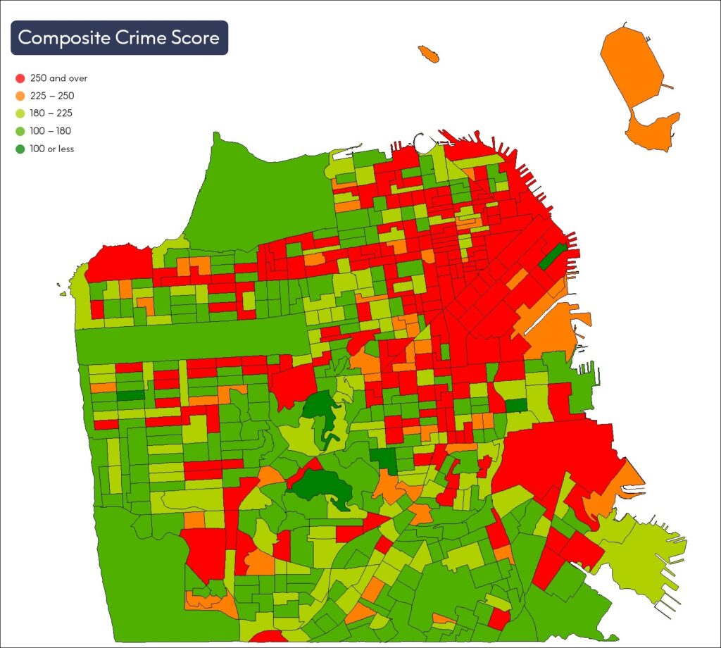
CrimeIndex measures the likelihood of where crime may occur and provides crime risk scores at the granular block group level. Context Crime Index combines Crime Index and Neighborhood Boundaries to provide a comprehensive view of crime data for a neighborhood or local region.
ExchangeInfo Plus
ExchangeInfo Plus is an essential tool for visualizing and analyzing the telecommunications landscape and associated infrastructure data to support better business decisions. It is a comprehensive database containing key telecommunications infrastructure data for every wire center in the U.S. and Canada, describing the organization of the local telephone exchange system.
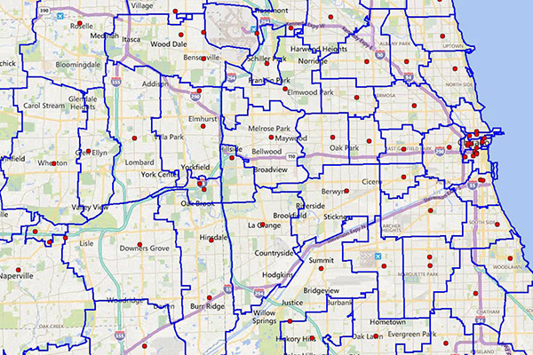
EmergencyInfo Pro
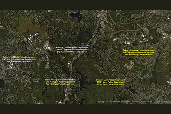
EmergencyInfo Pro is a compilation of Public Safety Answer Point (PSAP) and Authority Having Jurisdiction (AHJ) agencies throughout the United States, providing a geographic depiction of the EmergencyInfo system. It helps users determine which 911 call center serves emergency calls at a particular location and supplies unique contact information for emergency medical service (EMS), fire, or police agencies. It is a database of police, fire, and EMS service areas in the U.S., essential for understanding public safety infrastructure as mobile phones replace landlines.