School Grounds

School Grounds provides accurate polygons that define the geographic extent of the campus for public schools across the U.S.
ExchangeInfo Plus
ExchangeInfo Plus is an essential tool for visualizing and analyzing the telecommunications landscape and associated infrastructure data to support better business decisions. It is a comprehensive database containing key telecommunications infrastructure data for every wire center in the U.S. and Canada, describing the organization of the local telephone exchange system.
EmergencyInfo Pro
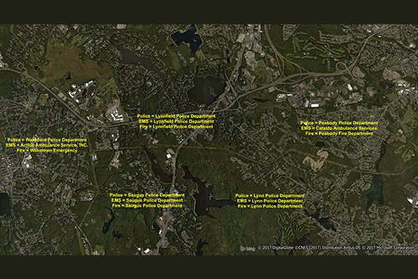
EmergencyInfo Pro is a compilation of Public Safety Answer Point (PSAP) and Authority Having Jurisdiction (AHJ) agencies throughout the United States, providing a geographic depiction of the EmergencyInfo system. It helps users determine which 911 call center serves emergency calls at a particular location and supplies unique contact information for emergency medical service (EMS), fire, or police agencies. It is a database of police, fire, and EMS service areas in the U.S., essential for understanding public safety infrastructure as mobile phones replace landlines.
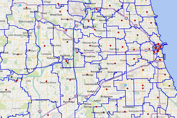
CallingAreaInfo
CallingAreaInfo represents the local calling plans available to business and residential customers when calling from or into a given location. It includes details on number plan areas (NPAs), the first three digits of the phone number after the area code (NXXs), and associated rates. It offers advanced data and geographic visualization capabilities to identify, analyze, and understand local calling plans and rate structures for specific geographic regions.
AreaCodeInfo
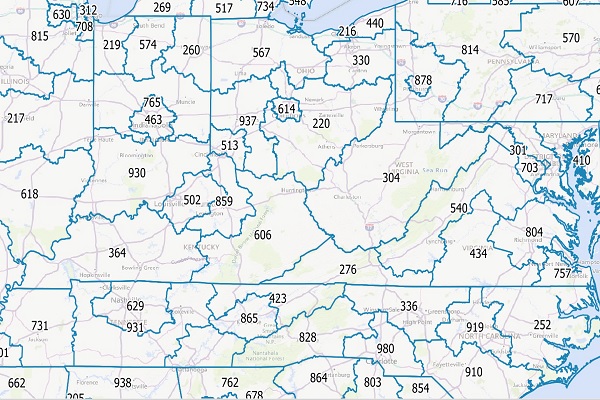
AreaCodeInfo represents delineated boundaries for landline telecommunications across the U.S. and Canada, covering 353 area codes with regular updates for accuracy.
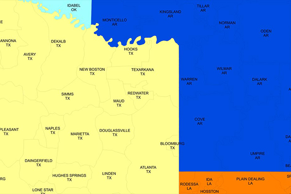
LATAInfo
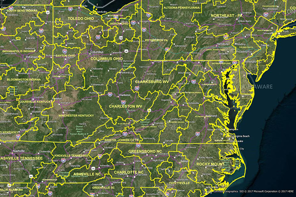
LATAInfo is a map database of Local Access Transport Areas (LATAs) across the United States, used to determine whether a telephone call is carried by a local exchange carrier or a long-distance provider. Each LATA generally contains a single major metropolitan area, with calls within a LATA routed by Local Exchange Carriers (LECs) and calls between different LATAs transported by long-distance carriers.
Premium Address Points
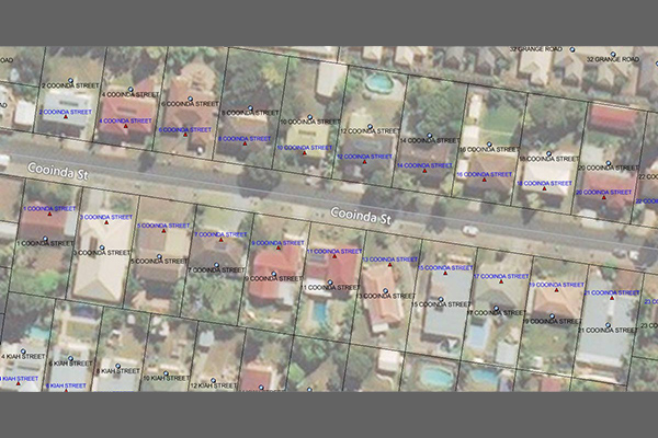
Premium Address Points provides comprehensive, easy-to-use, and nationally consistent location-enabled address data for Australia. It includes a complete data structure and a simplified data model for mapping, analytics, and routing, with enhanced geocoding options and linkages to land parcels, postcodes, localities, and statistical boundaries.