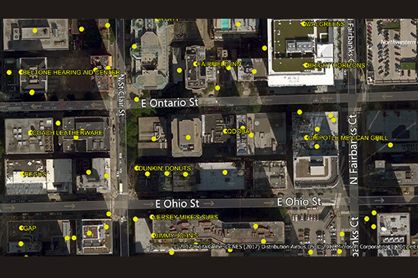
World Points of Interest – Premium
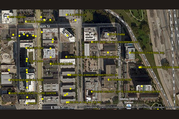
World Points of Interest – Premium provides location and detailed company information for a diverse set of commercial and retail businesses, leisure, landmark, and geographic features in more than 170 countries and territories, covering over 250 million POIs, with more than 27 million in the U.S. It is geocoded using Precisely’s premium geocoding solutions for accuracy and includes a unique PreciselyID for each addressable POI for streamlined data management.
Place Intelligence Metrics Dataset
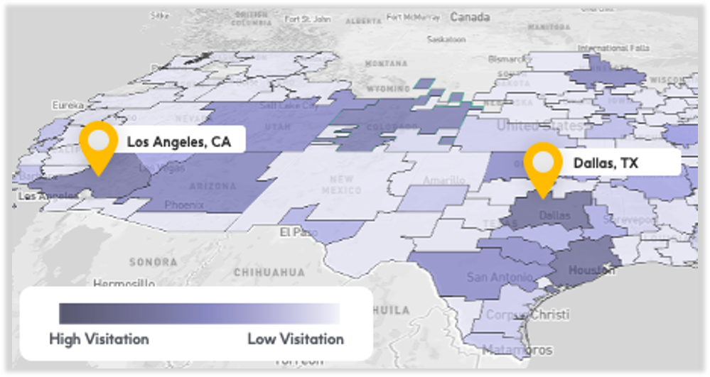
Place Intelligence Metrics is a comprehensive dataset providing location-based metrics for over 8 million points of interest, enabling custom analytic visualizations around visitation trends, consumer demographic attributes, cross-visitation behaviors, and trade area analysis for enhanced decision-making.
Auto Dealers
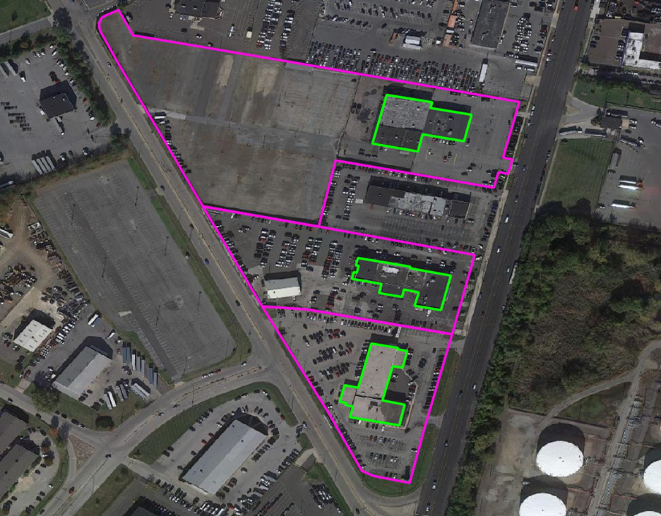
The Auto Dealers dataset provides precise delineation of automotive dealership boundaries, including developed areas for vehicle display, sales and service operations, and overflow lots, along with the primary building footprints for significant structures. Covering both franchise (new car) and independent (used car) dealerships.
School Grounds
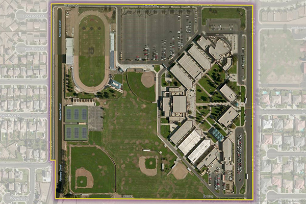
School Grounds provides accurate polygons that define the geographic extent of the campus for public schools across the U.S.
Hospitals
The Hospitals dataset provides precise polygonal boundaries for general care hospitals with 24-hour emergency services and specialty facilities such as VA and cancer centres across the United States. Each boundary captures the primary hospital campus, including the main building, patient and visitor parking, and, where appropriate, satellite facilities like clinics and administrative offices.
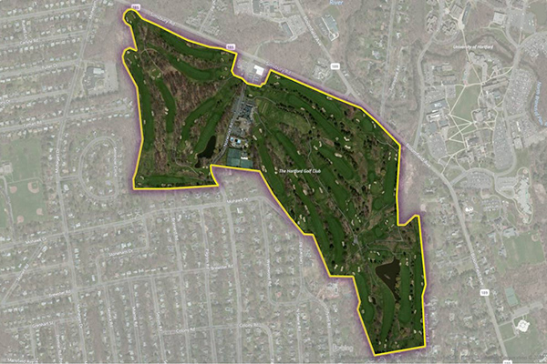
Golf Courses

The Golf Courses dataset provides a detailed delineation of the physical extent of public and private golf courses across the United States, including greens, fairways, clubhouses, parking areas, maintenance facilities, outbuildings, and associated residential developments. Developed in partnership with the National Golf Foundation (NGF), this dataset leverages the leading authority on golf course location to deliver the most complete and current spatial dataset.
Colleges
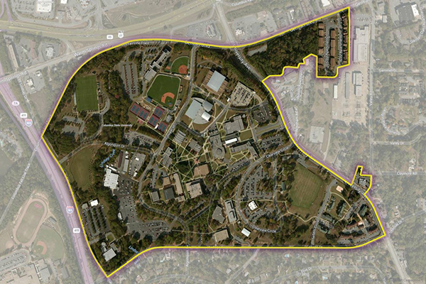
The Colleges dataset provides a series of polygonal boundaries around two-year and four-year colleges and universities in the United States with an enrollment greater than 200, reflecting both main and satellite campuses. Buildings or properties associated with a college are included if adjacent or nearby, but isolated buildings are generally not included. Additional polygons are created for separate facilities with concentrations of students, and some colleges have multiple polygons for geographically dispersed campuses.
Shopping Boundaries
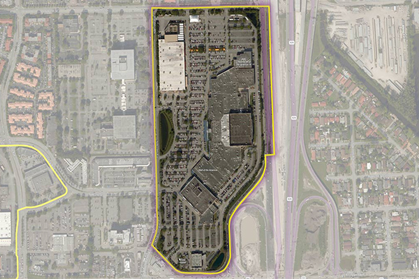
The Shopping Boundaries delineate geographic boundaries around U.S. shopping locations, focusing primarily on larger metropolitan areas. They include buildings or areas associated with shopping locations and are designed to enclose retail stores, services, restaurants, and parking areas.
Airports
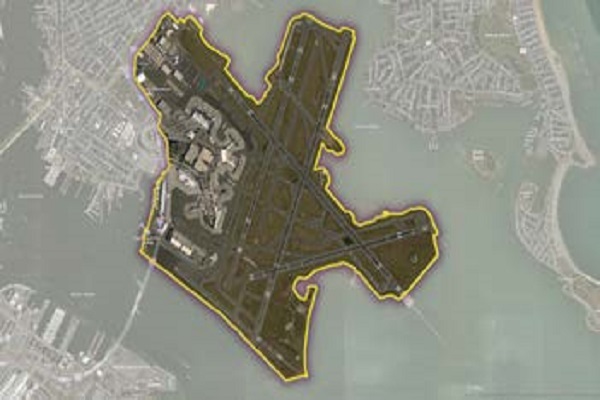
The Airports dataset provides precise delineation of public and private airport facilities, including terminals, hangars, maintenance buildings, runways, helipads, tarmacs, parking areas, and satellite lots, using authoritative sources such as the Federal Aviation Administration (FAA) and the National Flight Data Center (NFDC), with continual updates to ensure accuracy and currency.
World Points of Interest – Premium – Consumer
The World Points of Interest Premium Consumer dataset provides location and detailed company information for consumer-focused retail and service businesses, leisure, landmarks, and geographic features in more than 175 countries and territories. It includes a unique identifier, PreciselyID, for each addressable POI to streamline data management and enrichment.