Dynamic Neighborhoods
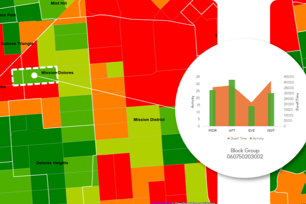
Dynamic Neighborhoods provides a powerful view of how populations move, gather, and engage across communities by combining rich visitation and demographic data. It reveals how busy neighborhoods are, how populations flow through them, and how these dynamics shift across different demographic cohorts and over time. The dataset is analysis-ready with pre-aggregated information at the U.S. census block group level and pre-calculated metrics on activity, dwell time, and location importance.
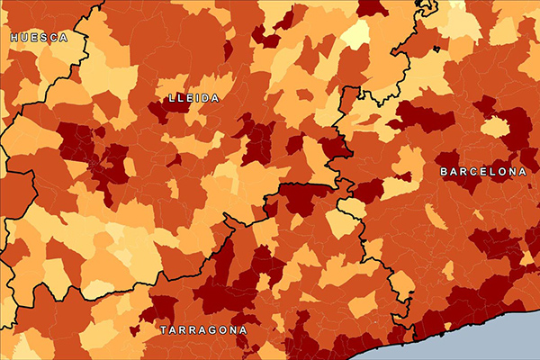
PSYTE™ Geodemographic Segmentation
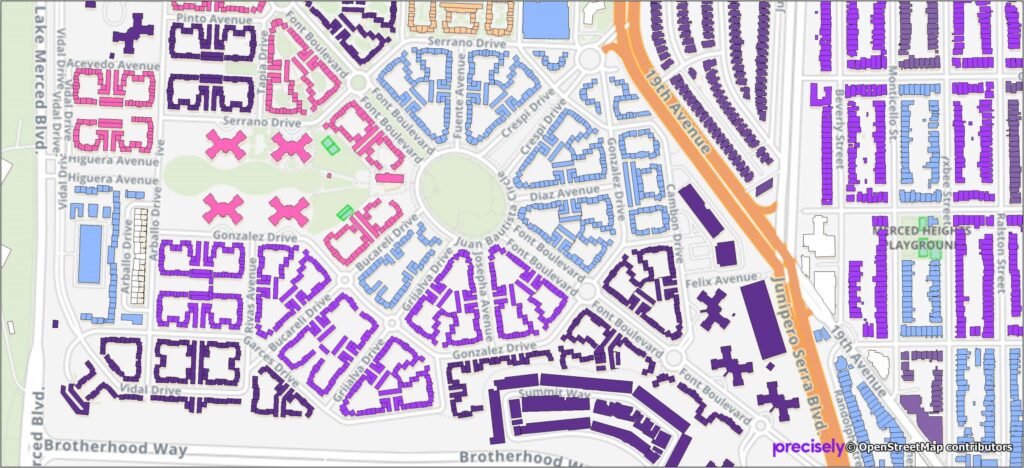
PSYTE™ geodemographic segmentation data products provide an easy-to-understand classification of neighborhoods based on shared socioeconomic and lifestyle characteristics such as age, income, and education. They enable users to understand customers, discover new target markets, and personalize outreach with intuitive neighborhood segmentation based on hundreds of variables and simple labels like “Metropolitan Young Elite.”
Precisely currently offers four PSYTE™ geodemographic data products:
PSYTE™ US geodemographic data
PSYTE™ Canada geodemographic data
PSYTE™ UK geodemographic data
PSYTE™ Australia geodemographic data
Context Walkability
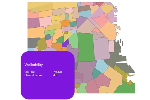
Context Walkability summarizes the level of accessibility to leisure, amenity, and other points of interest when walking. Each walkability score uses data on street intersection density, proximity to transit stops, and variations in land use to measure the probability of people walking as a mode of transportation. Scores range from 0.0 to 5.0, with higher scores indicating geographic regions more conducive to walking.
Estimates and Projections
Estimates and Projections makes it easy to understand current population characteristics and predict future changes in the demographic landscape, based on variables such as total population, total households, population characteristics (age, sex, composition), and household characteristics (income). These variables are updated to current year and projection values using rigorous, proprietary processes.
Daytime Population
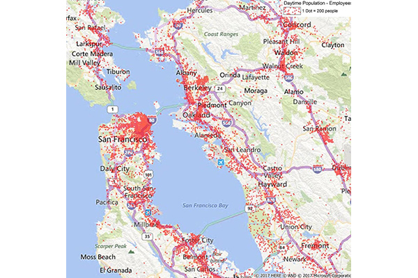
Daytime Population provides estimates of the number of people likely to be within a designated area during normal business hours, based on compiled business data including the number of employees at each business location. These estimates are aggregated to calculate daytime employees, which are then added to the at-home residential population (including retired, in school, or not in the labor force) to arrive at a total daytime population.
GroundView Demographics
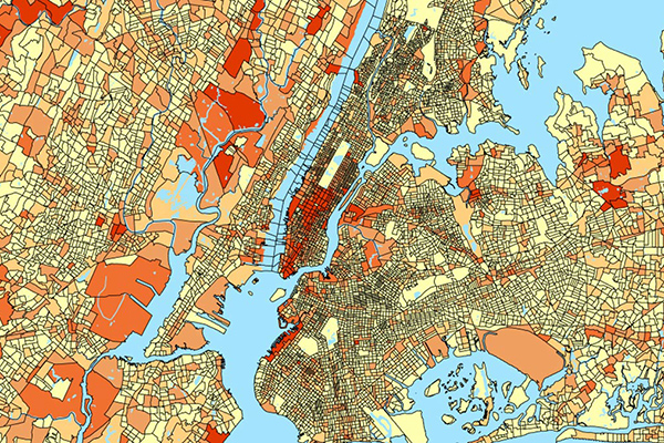
GroundView datasets deliver vital socioeconomic information within a geographic context for a deeper understanding of current and potential markets, including household income and consumer spending habits. It provides thousands of variables for insights at the block group level to support intelligence-based marketing, planning, and expansion strategies.
Context School Rankings
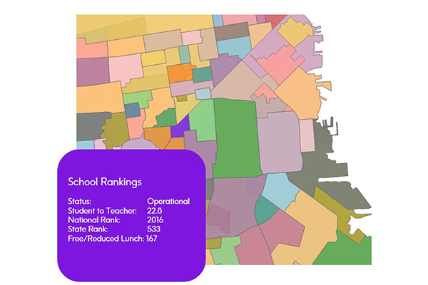
Context School Rankings provides state-wide school performance rankings, math and reading test scores, historical rankings, and school profiles for a specific geographic area. It offers a comprehensive view of public schools throughout the U.S. with over 80 combined attributes, designed to work seamlessly with public school points and school attendance zones data.
Context Commuter Score
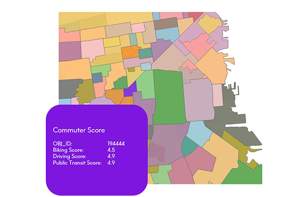
Context Commuter Score provides transportation data which allows users to rate the navigability of an underlying geography. Scores range from 0.0-5.0, with a higher score indicating more commuter opportunities. Biking, driving, and public transit data are all provided and scored.
Global Demographics
Global Demographics provides comprehensive coverage of global demographics such as population, age, sex, race, and disposable income as they relate to local administrative and/or postal geographies, extending to 140 countries globally, offering information on 6.7 billion consumers.
Context Weather
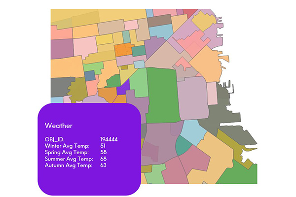
Context Weather provides a series of climate scores derived from measuring and modeling climate data over time and across stratified geographies, including average high and low temperatures, precipitation, snowfall, sunny and cloudy days, wind chill, and heat index by month.
Context Real Estate
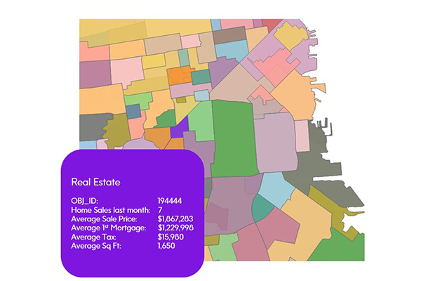
Context Real Estate consists of two datasets: Context Real Estate Sales, providing quarterly analytics of sales trends, average sales price, mortgage metrics, and other sales metrics derived from public records; and Context Real Estate Inventory, offering a snapshot of neighborhood properties including median tax rate, average year built, property types, and occupancy, also derived from public records.
CrimeIndex & Context CrimeIndex
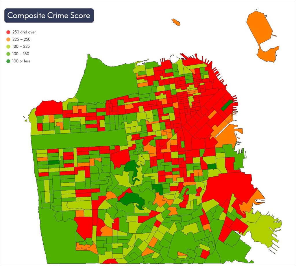
CrimeIndex measures the likelihood of where crime may occur and provides crime risk scores at the granular block group level. Context Crime Index combines Crime Index and Neighborhood Boundaries to provide a comprehensive view of crime data for a neighborhood or local region.