Context Walkability
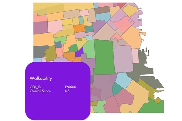
Context Walkability summarizes the level of accessibility to leisure, amenity, and other points of interest when walking. Each walkability score uses data on street intersection density, proximity to transit stops, and variations in land use to measure the probability of people walking as a mode of transportation. Scores range from 0.0 to 5.0, with higher scores indicating geographic regions more conducive to walking.
Estimates and Projections
Estimates and Projections makes it easy to understand current population characteristics and predict future changes in the demographic landscape, based on variables such as total population, total households, population characteristics (age, sex, composition), and household characteristics (income). These variables are updated to current year and projection values using rigorous, proprietary processes.
StreetPro 2500
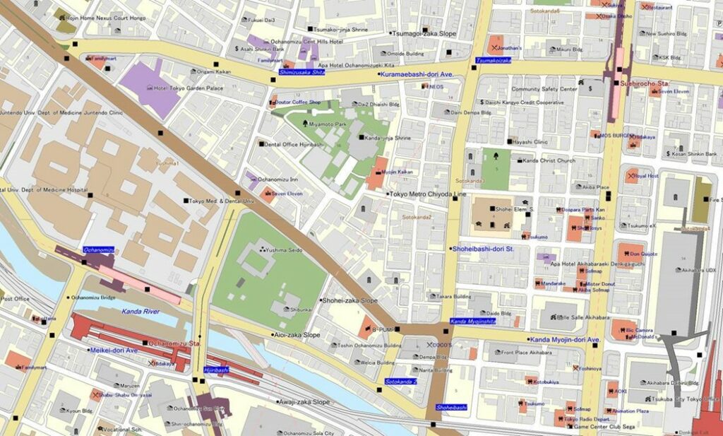
StreetPro 2500 contains map information, including roads and railways, for all of Japan. Detailed building shape outlines are provided for urban areas and their satellite regions, making it possible to determine the precise location of each customer.
StreetPro Display
StreetPro Display is a fully attributed vector GIS dataset containing streets, administrative areas, gazetteer, transport, land use, and points of interest data. It is an attributed, interactive dataset for geographic and spatial functions, built using data from geocoding software, and can be delivered with MapInfo Routefinder Networks for desktop geocoding, backdrop mapping, attributes, and context for drivetime and routing analysis. It provides robust street-level data for mapping, analysis, routing, and geocoding.
Daytime Population
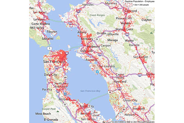
Daytime Population provides estimates of the number of people likely to be within a designated area during normal business hours, based on compiled business data including the number of employees at each business location. These estimates are aggregated to calculate daytime employees, which are then added to the at-home residential population (including retired, in school, or not in the labor force) to arrive at a total daytime population.
GroundView Demographics
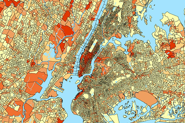
GroundView datasets deliver vital socioeconomic information within a geographic context for a deeper understanding of current and potential markets, including household income and consumer spending habits. It provides thousands of variables for insights at the block group level to support intelligence-based marketing, planning, and expansion strategies.
Context School Rankings
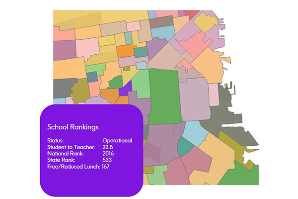
Context School Rankings provides state-wide school performance rankings, math and reading test scores, historical rankings, and school profiles for a specific geographic area. It offers a comprehensive view of public schools throughout the U.S. with over 80 combined attributes, designed to work seamlessly with public school points and school attendance zones data.
Context Commuter Score
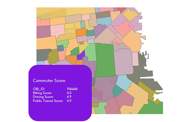
Context Commuter Score provides transportation data which allows users to rate the navigability of an underlying geography. Scores range from 0.0-5.0, with a higher score indicating more commuter opportunities. Biking, driving, and public transit data are all provided and scored.
Hospitals
The Hospitals dataset provides precise polygonal boundaries for general care hospitals with 24-hour emergency services and specialty facilities such as VA and cancer centres across the United States. Each boundary captures the primary hospital campus, including the main building, patient and visitor parking, and, where appropriate, satellite facilities like clinics and administrative offices.
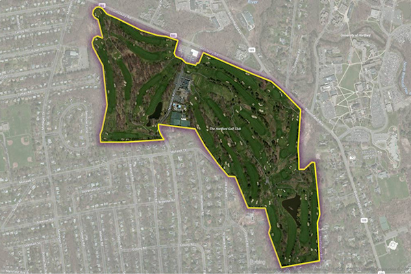
Golf Courses

The Golf Courses dataset provides a detailed delineation of the physical extent of public and private golf courses across the United States, including greens, fairways, clubhouses, parking areas, maintenance facilities, outbuildings, and associated residential developments. Developed in partnership with the National Golf Foundation (NGF), this dataset leverages the leading authority on golf course location to deliver the most complete and current spatial dataset.
Colleges
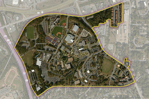
The Colleges dataset provides a series of polygonal boundaries around two-year and four-year colleges and universities in the United States with an enrollment greater than 200, reflecting both main and satellite campuses. Buildings or properties associated with a college are included if adjacent or nearby, but isolated buildings are generally not included. Additional polygons are created for separate facilities with concentrations of students, and some colleges have multiple polygons for geographically dispersed campuses.
StreetPro Traffic
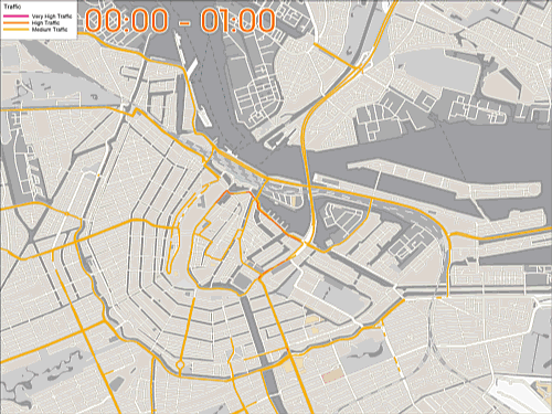
StreetPro Traffic provides information about relative traffic volumes on the StreetPro network, using anonymous feeds from billions of positioning devices within vehicles to offer speed, time, and direction of travel information. It provides aggregate counts of probe devices on road segments, aggregated as annual averages per direction of travel by day of week and hour of day, including additional aggregations for total average weekly, weekday, and weekend probe counts by hour of the day.