Precisely Advances Agentic-Ready Data with a New AI Agent, Data Product Marketplace, and MCP-Enabled APIs Read press release
Build solutions faster with Precisely APIs, pre-linked data, and MCPStart free trial
Privacy Notice Updates: We’ve updated our Privacy Notices to reflect changes to our services, new legal requirements, and the types of personal data we collect. Learn more
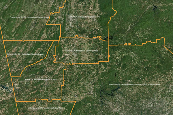
Core Based Statistical Areas (CBSAs) provides the geographic boundaries and point information for more than 900 statistical regions defined by the U.S. Office of Management and Budget, representing highly populated core areas and adjacent communities with high economic and social integration.
Coverage
United States
Product Family
Boundaries
Usage
CBSAs consist of counties and county equivalents, categorized into Metropolitan Statistical Areas and Micropolitan Statistical Areas. They provide nationally consistent geographic boundary definitions for collection, tabulation, and publication of federal statistics and content. CBSAs enable you to:
Assess needs and implement business decisions at a local geographic scale
Locate customers and enhance asset management
View and identify patterns and trends to make more informed logistics decisions