Geo-enrichment unlocks location intelligence for automated production processes. As organizations use more cloud computing the ability to include context derived from location intelligence as part of a digital transformation project can be missed. Location intelligence (AKA spatial intelligence, geospatial intelligence, or GIS) provides a significant advantage in understanding customers through insights data science. In this blog series we’ll look at the 3 benefits geo-enrichment can provide using big data and cloud native technologies, location determination, feature selection, and data extraction.
Geo-enrichment turbo-charges insights data science
Let’s begin with some location intelligence and geo-enrichment working definitions:
- Location intelligence (LI) is the insight from management, analysis, and visualization of location-based data
- Geo-enrichment is a location intelligence process that doesn’t need maps
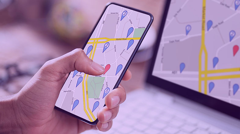
If you’re a visual person like I am then you can think of a LI process as a sequence of maps but maps aren’t needed if the data can be properly organized. Maps are great for analytical processes where someone makes decisions by viewing the LI information. However, with geo-enrichment maps are not needed and can slow down the delivery of LI value. For example, if a loan underwriter wants to look at the number and type of coffee shops within a reasonable drivetime near an upscale condo complex, they can do something similar to the steps below:
- Make a map of the condo complex area
- Generate 3-, 5-, and 10-minute drivetime polygons around the complex
- Count the shops that are inside the polygons
However, with geo-enrichment maps are not needed and can slow down the delivery of LI value. Automated geo-enrichment eliminates the time and skills needed to create maps of the 3 steps described above and automatically delivers the insight as part of the underwriting process. Underwriters can focus on other tasks. Geo-enrichment not only saves an organization time by automating LI processes it also delivers geospatial context and customized insight. Insight is simply a critical business answer such as, “This multi-dwelling unit is good for our loan product. The property value is high enough and we can project high occupancy rates because there are enough desirable social activities within a 5 minutes drivetime from where its located.” The easier it is for organizations to use geo-enrichment the more they benefit from pivotal dimensionality from a spatial data context. This increases data integrity and provides trusted data for analytics and training ML models.
Geo-enrichment helps organizations extract greater insight from LI. However, most geo-enrichment processes are not in the cloud. Or if they are using cloud environments, they’re separated from mission critical business processing environments. This is typically because they’re part of map-focused and map-based systems. Geo-enrichment that works within existing big data and cloud native technology provides an inline advantage because the LI insight is integrated into existing processing. For example, automated underwriting or fixed wireless determination can be done with Spark and Kubernetes technologies that provide integrated business decisions. Then as organizations move their processes to the cloud, they can simply call geo-enrichment micro-services to enrich their data as part of their digital transformation process. Or, if they have already moved their processes the cloud, they can add geo-enrichment when new cloud-based operations are created.
Good location determination delivers the best geo-enrichment
Location determination saves organizations millions of dollars every year. A wrong property location can expose an insurer to total loss. Or the wrong home location can negatively impact its loan value because the property value is unclear. The physical position of a property or outdoor asset such as a 5G antenna is the first step in the geo-enrichment process. If the location is inaccurate then all subsequent automated steps are diminished. This causes less confidence in the extraction of business insight from geospatial information. It is not only important to know the quality of locations but it’s even more valuable to know how to use them.
Download our white paper
Enabling Location Intelligent Insights Using Cloud-Native and Big Data Technology
Companies struggle to generate positive returns on big data implementations. Many find it difficult to generate actionable insight from their big data assets. Geospatial processing changes the dynamics. Data and cloud-native location intelligence makes vast quantities of data consumable using data enrichment and automated catchment creation.
A location determination 4 leaf clover
There are three ways to determine locations and one way to know if they are any good:
- Forward geocoding
- Reverse geocoding
- Use metadata
- Use location IDs
Forward and reverse geocoding
Forward geocoding is the first leaf. A forward geocode is when customer addresses are assigned a location – latitude and longitude. The location is then used for geo-enrichment. There are 5 terms that help organizations make the most out of forward geocoding:
- Address validation determines if an address is valid and deliverable using official postal address data
- Address verification matches address records against address reference data that is not official
- Address standardization breaks the information into a recognized format
- Address normalization creates consistency with the parts of the address
- A geocode is latitude and longitude associated with the address
All five terms must be quantified to accurately geo-enrich business data, provide geospatial context, and inform downstream analytics with insights data science.
Reverse geocoding is the second leaf. A reverse geocode is used when customer locations (latitude and longitude) are processed to find corresponding address information. Reverse geocoding is very useful for geospatial processes that need to use cell phone locations or IOT. To make best use of reverse geocodes that precision of the location and the quality of the assigned address must be understood.
Metadata
This leads to the third leaf. Metadata is third leaf on the clover and tells an organization the quality of their forward and reverse geocodes. Good metadata design captures the impact of the 5 terms from forward geocoding and reverse geocoding’s location quality and assigned address information. Mission critical LI cannot be done without metadata. In an automated geo-enrichment process metadata is the only way to know how if a location can be used.
Trying to automate hundreds of millions of customer locations without accurate, easy to integrate metadata is like making gold from lead. Without address validation or verification, the quality and location of the addresses used become guesses. For example:
101 SE 1st Street, Miami, Florida
vs
101 SW 1st Street, Miami, Florida
These are 2 different addresses and locations. But if the customer address stored is “101 1st Street” which of the above addresses should be used? This is why metadata is critical. Without it you could be working with a location on the wrong side of 1st Street.
Metadata improves efficiency. A $20 million estate will get mapped and reviewed by an underwriter. But a $200 thousand home may not get that kind of attention. Lower-valued properties can be over- or under-valued if the location is not accurate. Without using the metadata for evaluating the property its policy can either be lost to a competitor or become a high-risk policy that has to be removed. It may be the traditional approach to have underwriters review properties that have questionable location information. But this practice creates less confidence in the underwriting process because it is based upon underwriter opinions.
Location IDs
The location ID is the fourth most magical leaf on the location determination 4 leaf clover. A location ID is a unique ID assigned to every address that has a valid geocode. Location IDs become most valuable in Spark (or other big data) processing scenarios. A location ID, such as the PreciselyID or geohash, allows fast ordering of location information by not just it’s geocode but also associated addresses. PreciselyIDs are the highest quality form of location IDs that come from verified addresses with confirmed locations. A geohash can be used in countries that don’t have PreciselyIDs. Some organizations may have their own version of location IDs that can be used too.
Organizations use Spark (or EMR on AWS) to match addresses with location IDs with complex and costly to calculate location intelligence data. Human mobility, elevation calculations, and weather feeds are hard to integrate into automated processes because they come from different sources, diverse formats, provide large amounts of data, and require more computational resources.
Once this type of LI data is paired with location IDs it is now organized by addressable locations and can be stored for quick access at later times using location ID’s as keys. Queries are so fast that organizations can reference LI in customer facing web applications with 1/10 the computational time. The location ID makes location intelligence available for organizations that don’t have large GIS investments because it doesn’t cost as much to set up and integrate the location data into their operations. This is how organizations can use cloud based geo-enrichment to make better decisions that will save computing expense and time.
Using location determination in geo-enrichment to yield business insight
Location determination and insights data science is an involved step in geo-enrichment and should be undertaken with proven tools and expertise. Unlock the power of location using a location ID to enrich business data and make complicated location intelligence processes such as routing easier to automate. When done correctly, location determination can dramatically improve insight, building trust in your data for faster, more confident decisions.
Join me in Part 2 of this blogs series “Automating geospatial processing with cloud technology” when I explore how routing can be automated to provide additional business insight using feature selection and data extraction.
Kubernetes geocoding in Github
For more information and examples on how to use geocoding in Kubernetes see the Precisely page on Github.
To learn more about the technology behind insights data science and location determination, read our white paper:Enabling Location Intelligent Insights Using Cloud-Native and Big Data Technology.