Customer Story
How Location Intelligence technology is helping Somerset prepare for the unexpected
![]()
46,000
households
217
square miles covered
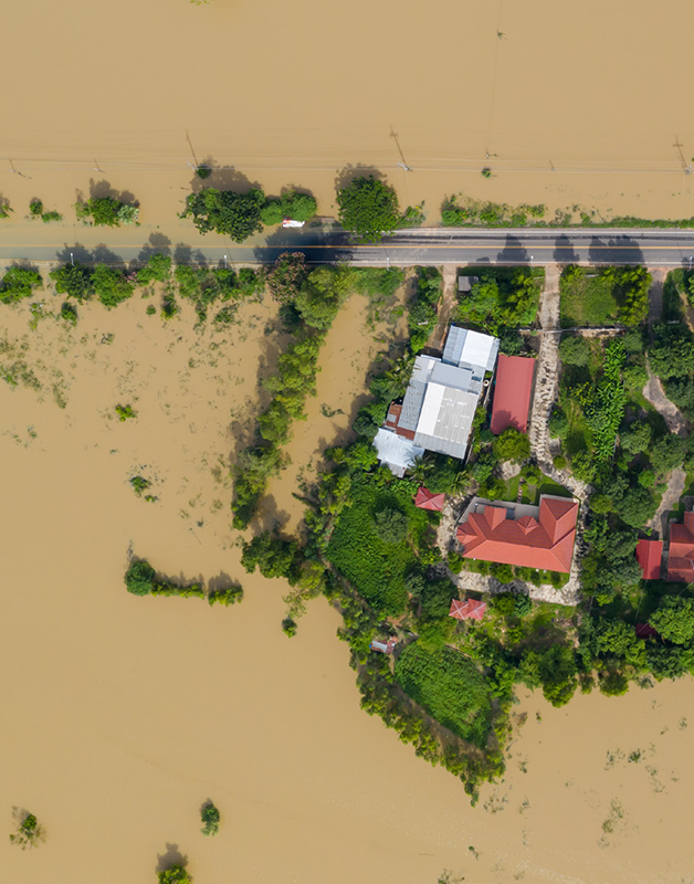
Introduction
The District of Sedgemoor which lies within the heartlands of rural Somerset, was one of the worst affected. Sedgemoor District Council serves this area, which has a population of 46,000 households and covers 217 square miles of the county, from the Mendip hills across the Somerset levels. The council is responsible for management across various areas of Sedgemoor life, including planning, building, housing, community, living, waste and the environment.
As well as working hard to bring the region and its economy back to its former glory following the floods, the council has been taking significant steps to minimise the impact of similar weather conditions this season, and location intelligence technology is set to play a key part.

“Damaging floods hit the region. Earlier this year, parts of Somerset were deluged by rain, causing floods which isolated communities and devastated farms as high tides and gale force winds battered the county. Floodwaters reached 8 feet in some areas, causing the evacuation of hundreds of people from their homes and resulting in millions of pounds worth of damage.”
Using location analytics to minimise risk.
Location intelligence technology draws together information from different sources – maps or geographic information systems for example – providing meaningful data which can be analysed in detail. Sedgemoor District Council is now able to tap into its own valuable data resources across the region.
Sedgemoor District Council is using Precisely’s Spectrum Spatial solution, which provides a platform that enables organisations to easily leverage, centralise and integrate complex spatial data across the organisation. Accurate, real-time spatial analytics are shared amongst staff and used for operational and strategic data-driven decision-making. Analysing this information means it can understand the area’s exposure to risk, help the region prepare itself for the unexpected, and work to ensure contingencies are put in place.
Critically for the council, the technology integrates easily with existing systems, so that different datasets – past, present or predictive – can be pulled together and analysed to create a clear picture.
The Council can map the properties and addresses worst hit by flooding in the past, and most vulnerable to flood risk in the future. Its use of location intelligence technology goes beyond flood management: it is used across the region to identify and improve the management of activity such as waste collection, planning, and the upkeep of outdoor spaces. Ultimately, it brings a more efficient, streamlined and controlled approach to improving the lives of citizens in the region.
Location intelligence in everyday life.
Whilst innovative in its use of location intelligence, Sedgemoor District Council is not the only local government authority making the most of these tools. Public sector organisations are now widely using this kind of intelligence behind-the-scenes to make decisions each and every day. Police use the tools to decide how to deploy resources based on crime statistics; highways agencies use spatial data to make decisions on traffic and road management; and healthcare services use location intelligence tools to identify population demographics, and tailor the services they provide.
For Sedgemoor District Council and its citizens, Location Intelligence is clearly playing a critical part in helping it improve the services it provides to citizens, come rain or shine.
Locate
Analyze location data for enhanced and actionable business insights that drive superior outcomes