Precisely Advances Agentic-Ready Data with a New AI Agent, Data Product Marketplace, and MCP-Enabled APIs Read press release
Build solutions faster with Precisely APIs, pre-linked data, and MCPStart free trial
Privacy Notice Updates: We’ve updated our Privacy Notices to reflect changes to our services, new legal requirements, and the types of personal data we collect. Learn more
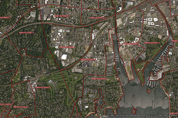
Census Boundary Bundle – US provides a visual backdrop for demographic and other business analysis in the United States. It can be purchased as a complete bundle that includes all seven layers, or as individual layer datasets.
Coverage
United States
Product Family
Boundaries
Usage
With Census Boundary Bundle – US, you can:
Define sales territories or service areas
Locate potential customers and track assets by enriching census boundaries with other datasets
Geocode policyholders and conduct point-in-polygon analysis to determine insurance rates
Utilize census boundaries with corresponding demographic and segmentation data to help determine where to expand