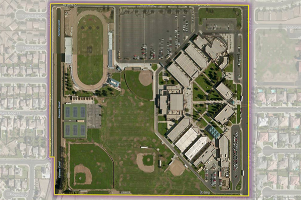
School Grounds
School Grounds provides accurate polygons that define the geographic extent of the campus for public schools across the U.S.
Benefits
- Control access to applications within school grounds
- Process and disseminate information and manage logistics during emergency events
- Develop knowledge and support mechanisms for early warning, mitigation, and response planning
Benefits
- Control access to applications within school grounds
- Process and disseminate information and manage logistics during emergency events
- Develop knowledge and support mechanisms for early warning, mitigation, and response planning
Features
- Provides rooftop latitude/longitude coordinates
- Includes school contact information including the physical address
- Links to NCES district and school IDs for additional school characteristics and features
- Change table details adds/deletes/changes from last release
- Quarterly updates detailing where changes and coverage expansion have occurred
ooioioiiiooioioiioiiooioiiiooiooiiioioioiiiooioioii
Specifications
Coverage
United States
Release schedule
Quarterly
Unit of sale
Country