Precisely Advances Agentic-Ready Data with a New AI Agent, Data Product Marketplace, and MCP-Enabled APIs Read press release
Build solutions faster with Precisely APIs, pre-linked data, and MCPStart free trial
Privacy Notice Updates: We’ve updated our Privacy Notices to reflect changes to our services, new legal requirements, and the types of personal data we collect. Learn more
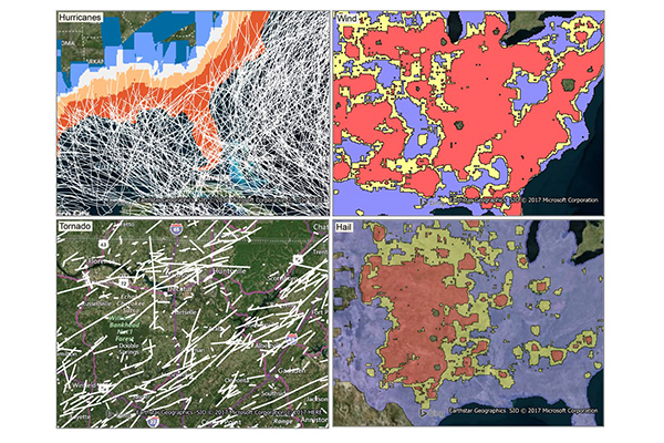
Historical Weather Risk contains comprehensive historical records of hazardous weather data including hurricane, hail, tornado, and windstorm events, with details on date, severity, and additional attribution like magnitudes, fatalities, injuries, crop/property damages, and meteorological details. Wind events use the Beaufort Wind scale, tornadoes use the Fujita-Pearson scale, hail events use the TORRO intensity scale, and hurricane events reference the Saffir-Simpson scale.
Coverage
United States
Product Family
Risks
Usage
Use Historical Weather Risk to:
Assess average weather risk exposure while writing new business
Calculate probable maximum loss with respect to the geographic distribution of insured networks
Add detailed context for calculating policy holder premiums and minimizing exposure
Understand historical tornado, hail, wind, and/or hurricane severity for a given location
Determine the aggregate weather risk of any geographic region
Understand historical counts and averages at the property level