Precisely Advances Agentic-Ready Data with a New AI Agent, Data Product Marketplace, and MCP-Enabled APIs Read press release
Build solutions faster with Precisely APIs, pre-linked data, and MCPStart free trial
Privacy Notice Updates: We’ve updated our Privacy Notices to reflect changes to our services, new legal requirements, and the types of personal data we collect. Learn more
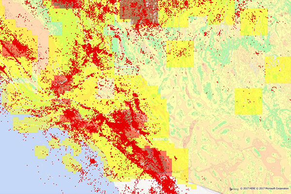
Earth Risk provides nationwide coverage of land-related risks including earthquakes, landslides, lava flows, sinkholes, and hazardous soils to help stakeholders understand risk by geography. Data layers are sourced from USGS, NEIC, Earthquake Hazards Program, and AMLIS.
Coverage
United States
Product Family
Risks
Usage
Earh Risk help you to:
Determine proximity to high susceptibility regions for mass movement events
Assign landslide, earthquake, and soil-related risk exposure to property locations during underwriting
Analyze earthquake data across an insured network to calculate geographic risk exposure, customer insurability, and probable maximum loss
Locate a property’s proximity to the nearest fault