Precisely Advances Agentic-Ready Data with a New AI Agent, Data Product Marketplace, and MCP-Enabled APIs Read press release
Build solutions faster with Precisely APIs, pre-linked data, and MCPStart free trial
Privacy Notice Updates: We’ve updated our Privacy Notices to reflect changes to our services, new legal requirements, and the types of personal data we collect. Learn more
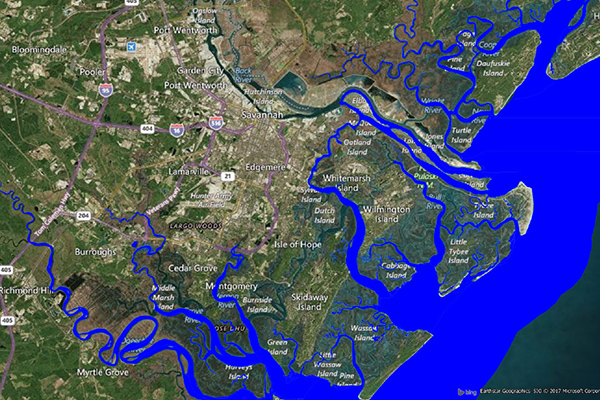
Coastal Risk contains information pertinent to shorelines and coastal areas subject to hurricanes, storm surge, flooding, and other natural disasters. It depicts the shape of the shoreline, name of the coastal water, and proximity to the nearest coastline.
Coverage
United States
Product Family
Risks
Usage
As climate-related catastrophes become increasingly common, analyzing hazard risk for coastal locations is more important than ever to ensure financial stability and to mitigate the damage caused by disasters. With Coastal Risk, you can:
Identify assets within close proximity to shorelines to understand risk exposure related to storm surge, tsunami, and low lying areas especially prone to flooding
Streamline underwriting workflows and price new business for profit
Make more informed property valuation, location planning, and risk assessment decisions