Precisely Advances Agentic-Ready Data with a New AI Agent, Data Product Marketplace, and MCP-Enabled APIs Read press release
Build solutions faster with Precisely APIs, pre-linked data, and MCPStart free trial
Privacy Notice Updates: We’ve updated our Privacy Notices to reflect changes to our services, new legal requirements, and the types of personal data we collect. Learn more
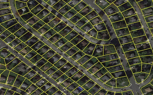
Parcel boundary data helps users map and analyze property characteristics across an area of interest, or conduct sophisticated spatial analysis such as proximity, overlay, and buffer zone operations. It contains polygonal property outlines and features like PreciselyID and Assessor Parcel Numbers for interoperability with property attributes, building footprints, U.S. Census Bureau data, and address genealogy. It is part of the property data enrichment products that work with Property Graph and is available via Data Graph API.
Coverage
Australia
Canada
New Zealand
United Kingdom
United States
Product Family
Properties
Usage
Using Parcel Boundaries can help you:
Identify property location, centroids, and boundaries for display and spatial analysis
Quantify risks associated with flood, wildfire, or other hazards to accurately price insurance policies
Link to World Points of Interest, Property Attribute Assessments, and Buildings for improved location intelligence
Use geofencing to identify service vehicle locations or customer areas for location-based messaging
Assess damages after catastrophic events by overlaying parcel data on satellite imagery
Locate retail and site properties for sale and learn about surrounding geographies
Improve accuracy of tax jurisdiction assignments
Respond to outages more efficiently by defining serviced customers by a grid
Identify properties for retail locations and popup services.