
Geofences
- Precisely's geofence datasets deliver precise polygon boundaries around real-world locations that power precision marketing, real estate analysis, emergency response planning, and location-based consumer engagement.
Coverage
- United States
Product Family
- Places
Usage
Airports
- Assess how airport proximity affects residential and commercial property values
- Deliver real-time offers to travelers at the moment of arrival
- Reach hotel, transport, restaurant, and retail customers in high-intent moments
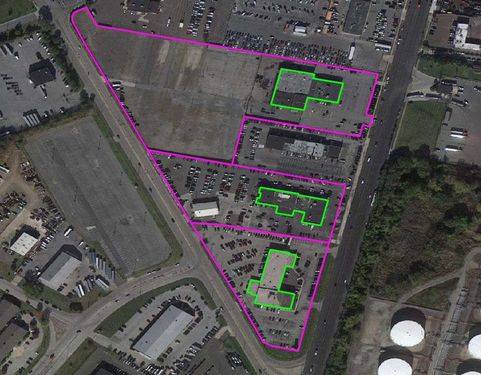
Auto Dealers
- Assess response to targeted messaging
- Improve site selection by identifying brand presence and competitive landscape
- Join dealership boundaries with demographic and retail data to analyze consumer behavior and income characteristics.
Colleges
- Geo-advertise to campus communities for local, regional, and national brands
- Target students with mobile messaging to drive engagement
- Support campus emergency response by providing first responders with reliable, real-time campus boundaries
- Minimize on-campus risk data-driven crisis management planning
Golf Courses
- Deliver personalized, context-sensitive, content to golfers and nearby audiences to drive engagement and loyalty
- Evaluate real estate opportunities where golf course proximity is a key selling point
Hospitals
- Highlight proximity to hospitals and medical facilities for homebuyers and commercial real estate
- Support emergency planning with hospital boundaries for resource allocation and disaster modeling
- Enable precision-targeted marketing and real-time crisis communication
School Grounds
- Control access to applications within school campus boundaries
- Disseminate information and manage logistics during emergency events
- Support early warning systems, mitigation planning, and disaster response
Shopping Boundaries
- Target shoppers at the right moment with special incentives when they are nearby
- Deploy geofencing for personalized push notifications
- Track consumer behavior to gain insights into dwell time, visit frequency, and cross-location patterns
Details:
Airports
- 4,700+ airport polygons across the United States
- Covers terminals, hangars, runways, helipads, tarmacs, parking and satellite lots
- Includes IATA and ICAO codes and enplanement data
- Sourced from the FAA and National Flight Data Center (NFDC)
Auto Dealers
- 44,500+ franchise and independent auto dealer polygons across the United States
- Includes dealership name, address, type (franchise vs. Independent), and brands sold and serviced
Colleges
- Polygonal boundaries for two- and four-year colleges and universities with enrollment greater than 200
- Covers main and satellite campuses with multiple polygons available for geographically dispersed institutions
Golf Courses
- Polygon boundaries for thousands of public and private golf courses
- Developed in partnership with the National Golf Foundation (NGF)
- Covers greens, fairways, clubhouses, parks, maintenance facilities, and associated residential developments
Hospitals
- Polygon boundaries for general care hospitals with 24-hour emergency services and specialty facilities, including VA and cancer centers
- Captures the primary campus including the main building, parking, and satellite facilities such as clinics and administrative offices
School Grounds
- Polygon boundaries for public school campuses
- Supports access management, proximity analysis, and public safety planning
Shopping Boundaries
- Polygon boundaries for retail trade zones primarily focusing on larger U.S. metropolitan areas
- Boundaries enclose retail stores, services, restaurants, and parking areas
Specifications
- Update Frequency
- Weekly (U.S.), Quarterly
- Coverage
- United States
- Unit of Sale