Precisely fait progresser les données « Agentic-Ready » avec un nouvel agent IA, une data product marketplace et des API compatibles MCP Lire le communiqué
Mises à jour des avis de confidentialité: nous avons mis à jour nos avis de confidentialité afin de refléter les évolutions de nos services, les nouvelles obligations légales applicables et les types de données à caractère personnel que nous collectons. En savoir plus
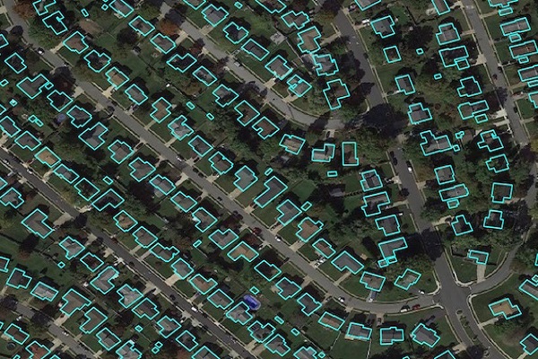
Precisely Buildings provides detailed footprints enriched with characteristics to provide property insights for insurers, telecoms, and location-based analytics. It includes unique identifiers, property essentials (FIPS, census block, address details), building basics (type and usage), location, and elevation (lowest, highest, and centroid). It enables interoperability and enrichment with other features like parcel boundaries and property characteristics, and is available via Data Graph API.
Coverage
Canada
New Zealand
United Kingdom
United States
Product Family
Properties
Usage
Insurance: Validate placement of insured structures, assess proximity to risks (flood, wildfire, shorelines, fault lines, crime areas), and understand co-tenant risk for commercial properties
Telecommunications: Provide location and structure information for infrastructure layout, installation planning, ensuring speed and bandwidth, and expediting emergency response like wireless 911 calls
Marketing: Utilize buildings as geofences for mobile advertising to refine targeted marketing based on proximity to eateries, stores, and services